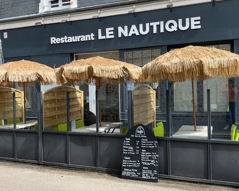
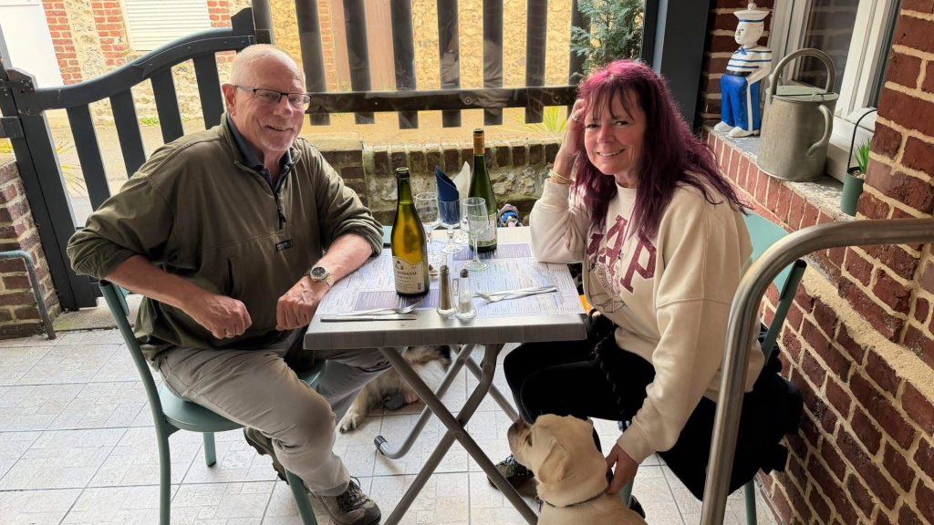
We always enjoy visiting Yport. We have overnighted here on at least four previous tours (T2, T7, T9 and T10) and one of the main reasons is the ‘Le Nautique’ restaurant. We always receive such a warm welcome there and the food is excellent. We stayed just the one night this time and didn’t get to see anything of the town other than Le Nautique and Flower Camping La Chenaie (which campsite seems to get better every visit). We’ll be back though.
We’re off to Bretagne next (Fougeres) and keen to get an early start. If you want to learn more about our earlier visits to Yport I would refer you to previous entries on this site but; having said that and to save you time, I have reproduced a few previous comments:-
“Nestled in between steep chalk cliffs on the Alabaster Coast, Yport was a tiny fishing village until beach holidays became fashionable in Europe in the late 19th century. It has since become a little a gem of a beach resort with a couple of very good restaurants and it’s own casino… The village is one of the smaller resorts in the region and contains a mix of tiny fishing houses and larger 19th century properties built at the time Yport was becoming established as a seaside resort and; it’s a fine place to while away a day or two…” – Tour 7
“One thing about Yport which stirs me every time I walk into the town is that almost breathtaking moment when, as you turn on to the beach from Rue Emmanuel Foy, you get hit by a rush of fresh salty sea air being channeled through the town by the chalk cliffs. Refreshing is an understatement; it’s almost energising” – Tour 7
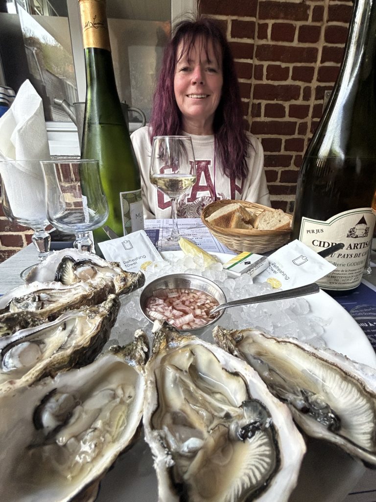
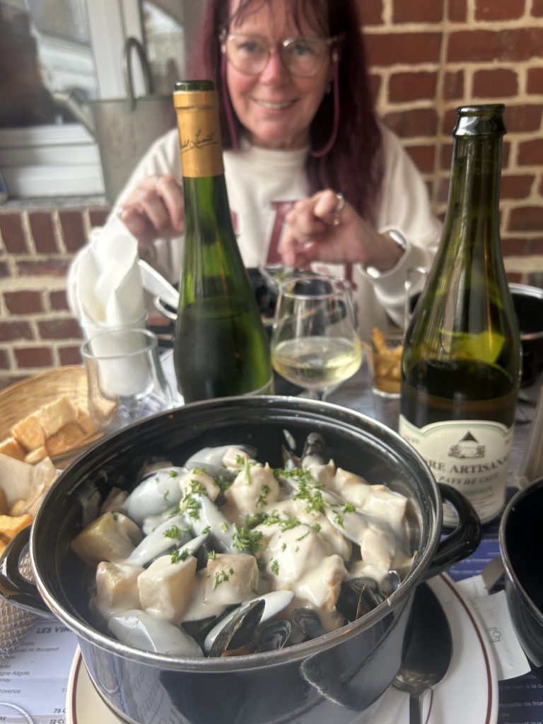
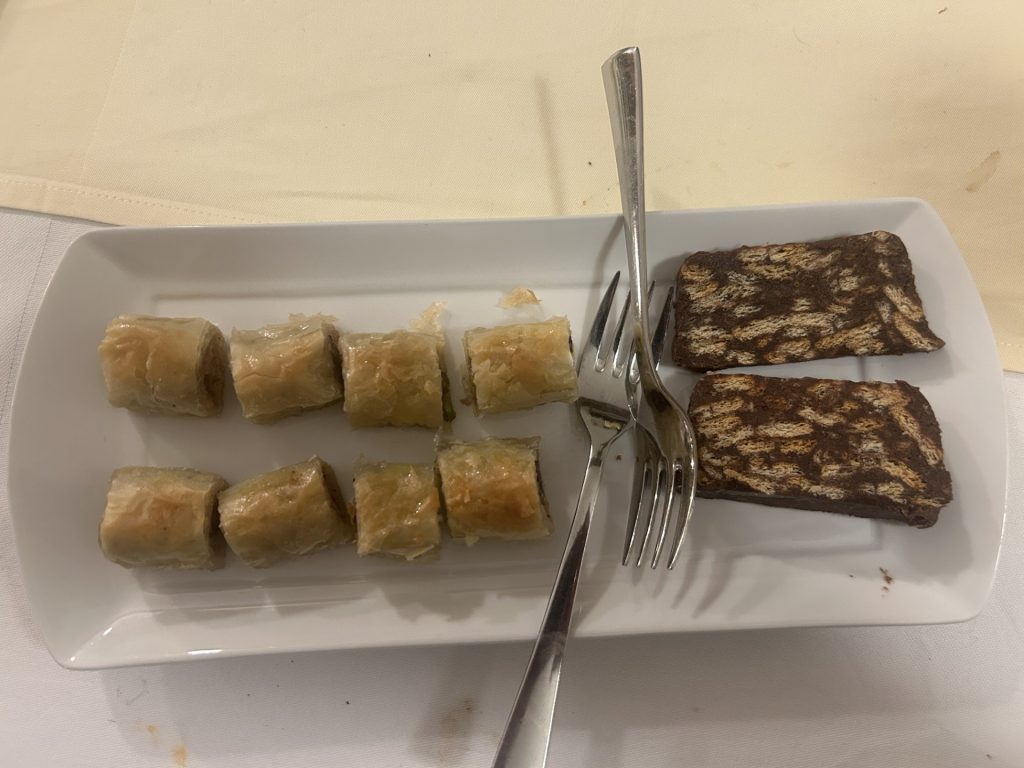
“Yport is also a great place to eat. There aren’t many restaurants or cafes in the town but they are all okay and, if you like fish (especially mussels), Le Nautique is outstanding. They love dogs there and the patron chef went out of his way once again to personally find a table for us in our preferred space at the back of the restaurant and cleared a space for Nala and her wheels. He couldn’t have been more accommodating...” – Tour 9
All our Van tours begin and end in France but most everything in between is determined by the weather – we chase the sun. This time it will be different because in three weeks time we are meeting our children and their partners in Portugal. They will be collecting rented motorhomes from a company in Porto, in the north of Portugal, and for a week or so we hope to introduce them to the delights of Portugal’s Norte Region and Spain’s Galicia. So we are on our way to Portugal via France and Spain.
Having said all that, we have a good three weeks before Porto and, currently, the weather in Bretagne is promising. We were last there during Tours 2, 4 and 5 and visited many interesting and beautiful places across all four departments – Ille Et Vilaine, Cotes D’Armor, Finistere and Morbihan. We decided to start this tour with a return to Bretagne.
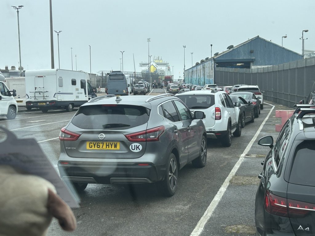
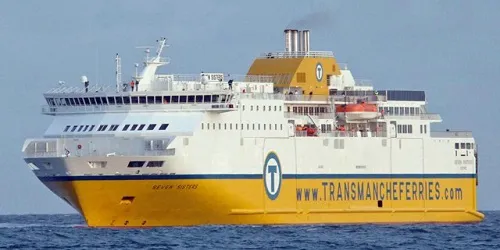
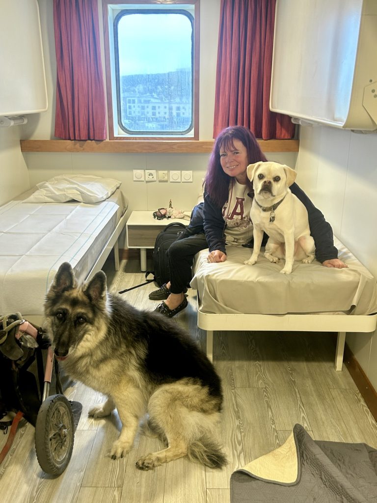
Wanting to maximise our time in Bretagne we crossed the Channel using the Newhaven/Dieppe ferry instead of the one from Dover to Calais. Dieppe is considerably closer to Bretagne than Calais. Neither Vanya nor I have used this prticular ferry since the i980’s and it’s not a crossing I would want to repeat in a hurry (they are simply not as slick in terms of embarking and disembarking as at Dover) but, hey, it worked not least because our motorhome is stored in Newhaven and we had secured a pet friendly cabin on the boat and could keep our two dogs with us.
As we set off from our home in Brighton, the weather was foul (cold, wet and foggy) but, by the time all formalities had been completed in Newhaven and we were invited to board the ferry (the Seven Sisters), things had improved and all four of us enjoyed a smooth crossing. They served a pretty good breakfast too.
The weather improved significantly as we waited to board…… and the crossing was smooth.
One other advantage of the Newhaven/Dieppe ferry: Dieppe is not very far from Yport which allowed us to visit our favourite restaurant in Normandy (Le Nautique) before continuing to Bretagne…
Settled at a fine little camp site (Camping Saint-Louis) in Autinges, a tiny village of less than 300 inhabitants, just 10 miles south east of Calais.
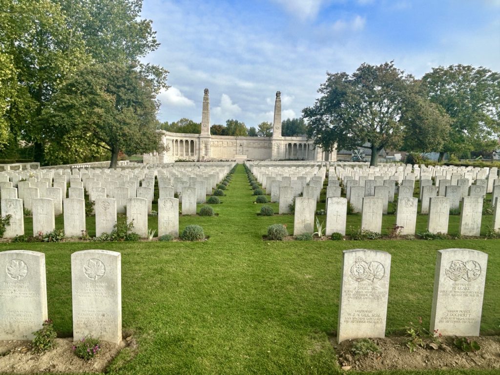
There’s little of interest in Autingues. We chose it because of it’s proximity to the ferry port in Calais. However, the journey from Cambrai took us near Haucourt and Arras and we paused at both these places; Haucourt to pay our respects to the fallen interred in the British & Commonwealth Cemetery and Arras because I had heard such promising things about the city.
The Vis en Artois cemetery at Haucourt is unusual by British standards in that a number of the graves contain the remains of two men. I’ve seen this before in German cemeteries but not in those managed by the War Graves Commission. This particular cemetery holds the graves of 1,748 British, 582 Canadian, 6 Australian and 2 South African soldiers and airmen. However, the memorial names a further 9,806 British and 16 South African soldiers who fell in this immediate area but have no known grave.
Vis En Artois Cemetery
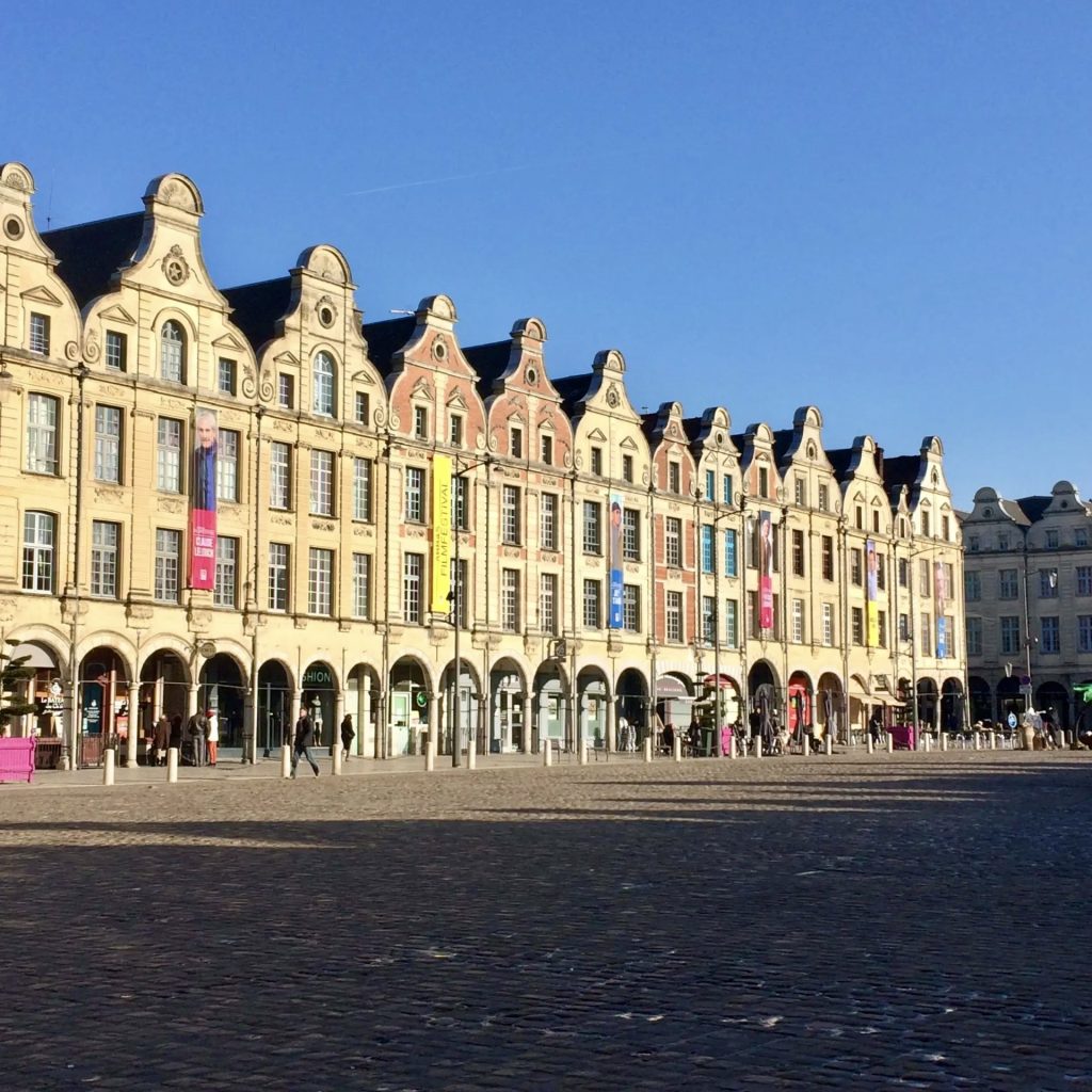
I had never previously visited Arras. It’s quite beautiful and I will certainly return for a longer stay. It has two fair sized market squares, La Grand Place and La Petite Place (also known as the Place des Heros) and markets are held on these squares on Thursday and Saturday mornings. Both squares are lined with ornate Flemish style town houses. They also hold a Belfry (the Beffroi d’Arras) and the City Hall. There are some fine views over the city from the top of the Belfry and, just as interesting, there’s an entrance near the City Hall to a well preserved network of tunnels (Les Boves de Arras) built underneath the city by British and New Zealand miners during World War I. The larger caves and tunnels were given names by the miners, the British naming sectors after towns in England (e.g. London, Liverpool and Manchester) and the Kiwis naming sectors after towns in New Zealand (Wellington, Nelson and Blenheim) and; the underground complex, which included a power station, light railway system and even a 700 bed hospital, became home to 24,000 Allied troops in the weeks leading up to the 1917 Battle of Arras. Guided tours through the caves and tunnels begin at the Carriere Wellington on Rue Arthur Deletoille and are highly recommended.
Much of Arras, including all the buildings on the two market squares, were completely destroyed during WWI. Indeed, by the end of the war in 1918, only 5% of the city’s houses were still habitable. So much had to be rebuilt. The good news was that sufficient records were unearthed to enable all the buildings on the two squares (the Belfry, the City Hall and the Flemish Town Houses) to be completely restored to their original specifications.
This was just a fleeting visit and I was unable to get a real feel for the city or see much more than the area around the two market squares but; there’s easily enough here to warrant a second, longer visit. There are two sites almost adjacent to each other which I definitely want to see next time. They are (a) the 17th century Citadel built by Vaubin known locally as ‘La Belle Inutile’ (i.e. the Beautiful Useless One) on account of it failing to prevent German occupation of the city in the last two World Wars and (b) the Arras Memorial which holds more than 2,650 British and Commonwealth Graves and a wall engraved with the names of a further 35,000 British soldiers who fell during the three WWI battles for Arras.
Also to be seen, a little to the north of the city, is the Canadian Memorial at Vimy Ridge; the French Necropolis of Notre Dame de Lorette; the nearby Ring of Remembrance (inspired methinks by the Vietnam Memorial Wall in Washington DC) and; the ruins of the 7th century Mont Saint-Eloi Abbey.
Arras is a deeply moving place and, for me, a must see. Lest We Forget.
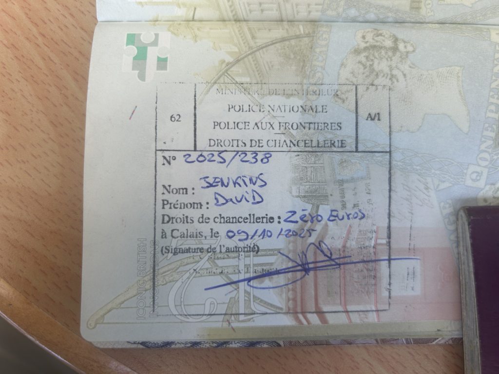
Roll on Tour 13… although it will be some time coming. It was a complete oversight on our part but; upon arriving at Calais to catch our ferry home we were advised by the local Gendarmerie that we had overstayed our allotted time on mainland Europe (Brexit) and so fell foul of Schengen. We were not aware that, despite electing against joining the EU, Norway and Iceland both subscribe to Schengen. As result, we stayed too long and received a 198 Euro per person fine. We also have a very much unwanted stamp in our passports…
Apologies, we’ve long since returned to the UK from Tour 12 and I’m still playing catch up with the blog. Just one more entry after this and I’m up to date.
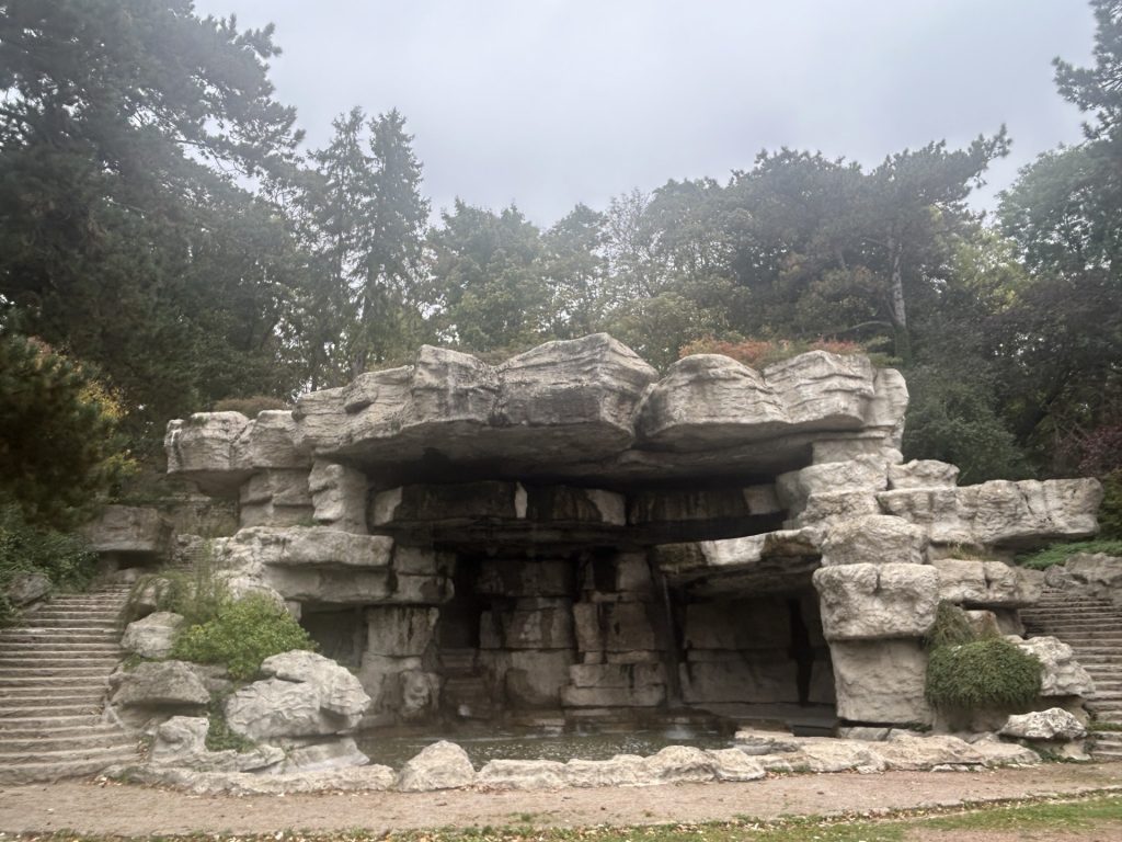
I was so disappointed with Cambrai. It looked such a mess. The place needs tidying up (the Jardin Des Grottes in particular was overflowing with trash) butI think too the city should employ someone with a better understanding of urban planning. Take a look at Cambrai and then visit Arras, less than 25 miles away, and you’ll understand precisely what I mean. Both suffered terribly during the two World Wars but while Arras has been transformed into something very appealing and is well maintained (it’s delightful), Cambrai is … well, very much the opposite. I think Cambrai lost it’s way a bit during it’s reconstruction after the two World Wars but, hey, that doesn’t explain all the rubbish scattered around the city. The last time I was moved to make such a comment, I was in Canterbury (at the start of Tour 1).
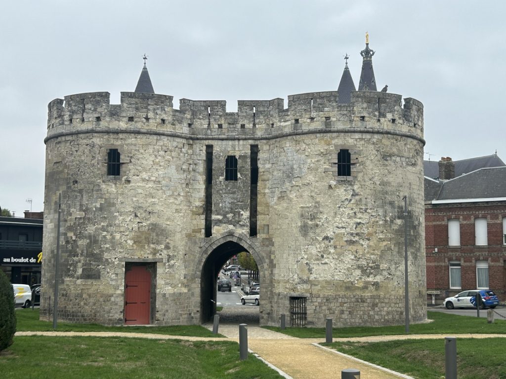
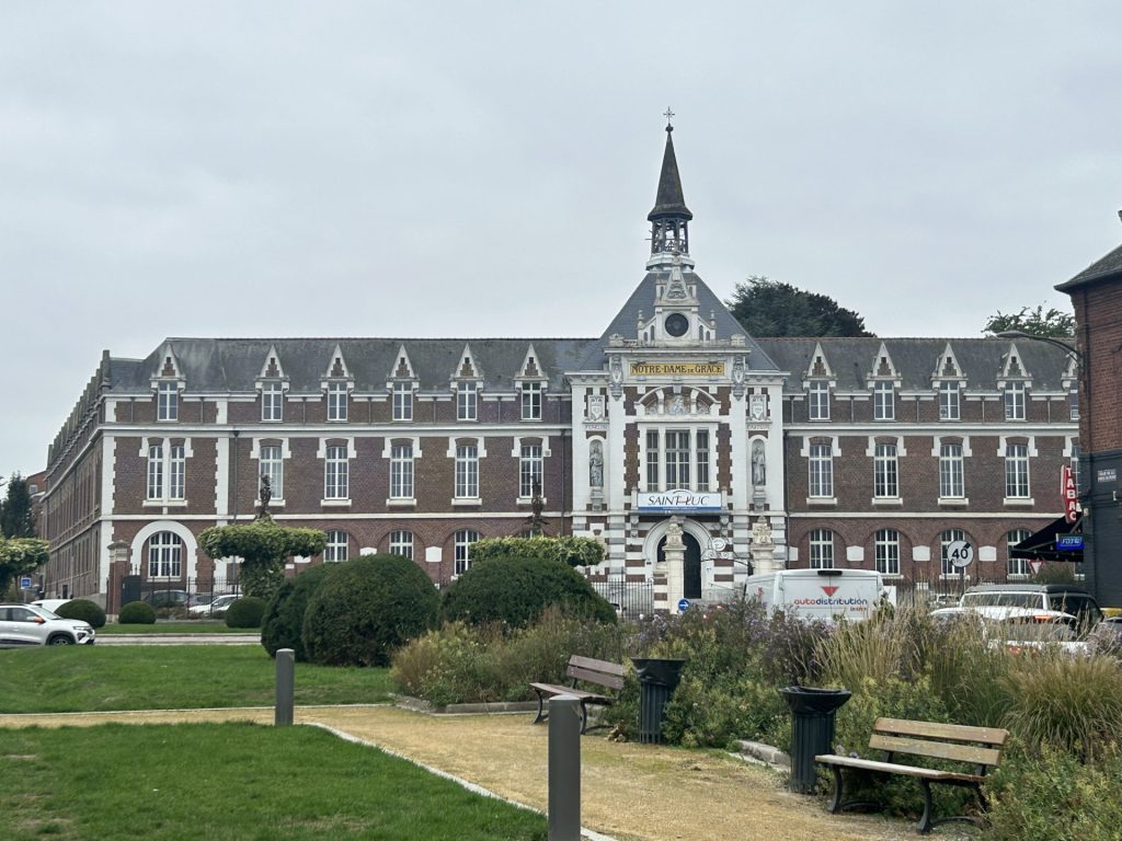
None of the above is to suggest that we will not one day revisit Cambrai. After all, Cambrai was classified as a city of history and art in 1992 and; there is much of interest yet to see both in the city and the surrounding area and; of course just like Canterbury, it can always be tidied up. Among the more interesting sites I did see during our visit were the Cathedral of Our Lady of Grace (beautiful inside although it doesn’t look much from the outside); an imposing Mairie (city hall) on the Place Aristide-Briand; a 15th century Belfry; the Chateau de Selles; the Porte de Paris (one of only two remaining gates into the city, the other being the Porte de Notre Dame); the Maison Espagnole (the sole remaining half timbered house in the city, now used as a tourist office) and; the Chapel des Jesuits (which is alongside the aforementioned Spanish House). Oh, I did also see the Eglise Saint-Gery and the city’s covered market but both were closed.
I approached the city centre from the municipal campsite; crossing Canal de Saint-Quentin on my way in and passing first L’Eglise Saint-Gery; then the Belfry; and, finally, City Hall. I missed out on the Rubens painting inside Saint-Gery but the interior of the Cathedral of Our Lady of Grace more than compensated for this disappointment.
L’Eglise Saint-GeryThe BelfryLa Maire
The Cathedral of Our Lady of Grace is actually Cambrai’s second cathedral; the first having been torn down during the French Revolution. This second cathedral was originally an early 18th century church which formed part of the Abbey of Saint-Sepulcre. It survived the Revolution only because the revolutionaries converted it into a ‘Temple of Reason’ as part of a strategy towards replacing Christianity with ‘State Atheism’. The strategy failed
The interior of the cathedral…… is filled with light
After enjoying the peace within the cathedral for a short while(I seemed to be the only one there) I crossed the Avenue de la Victoire to visit the local tourist office which, as I mentioned above, is housed in the only remaining half timbered house in Cambrai (the Maison Espagnole) and they kindly supplied me with a tourist map of the city which identified a few other nearby places of interest.
Cambrai is a compact little city and easy to explore. Adjacent to the Maison Espagnole is the Chateau des Jesuits with it’s beautifully sculpted facade and; a short walk south along the Avenue de la Victoire is the impressive Porte de Paris, one of the few surviving aspects of the city’s medieval walls. Beyond this old city gate is another fine looking building but I was unable to find out much about the place other than that it is a school now.
Maison EspagnoleChateau des JesuitsPorte de ParisThe School Building
I missed out on La Maison des Templiers, the Cambrai Tank Museum and the Cambrai Memorial but did get to wander the City Park with it’s Palais des Grottes and I passed by the covered market. I understand this market is only open twice a week. That was a shame because amongst other things I missed out on the Betises de Cambrai (assorted mint candies) which the city is famous for and it’s Maroilles Cheese Sauce. Next time.
Entrance to the city parkPalais des GrottesLe Marche Couvert…… and what I missed
Apologies, we’ve long since returned to the UK from Tour 12 and I’m still playing catch up with the blog.
Leaving Germany, we made our way to La Roche en Ardenne in Belgium. We travelled by way of the Luxembourg hamlet of Nommern; spending a night there so as to take the dogs to a vet in nearby Mersch in readiness for the journey home to the UK.
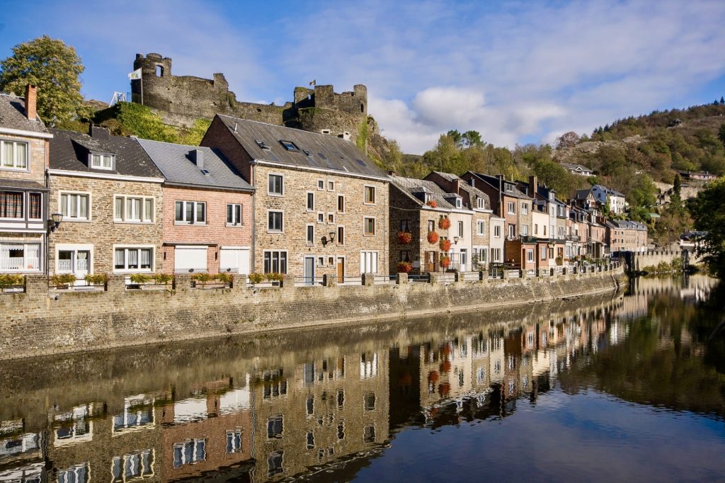
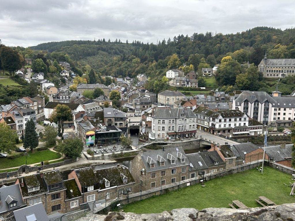
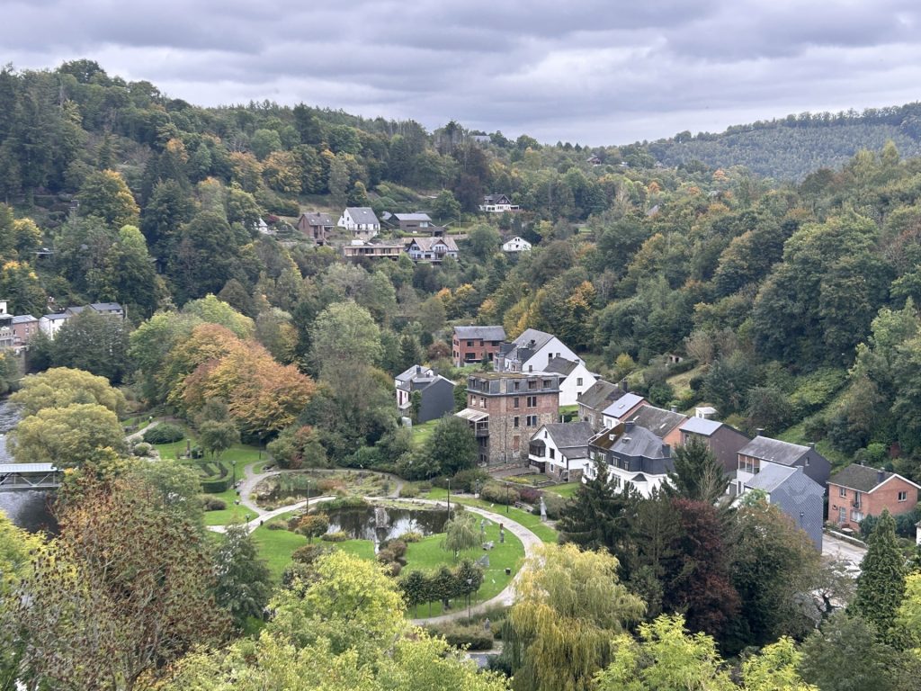
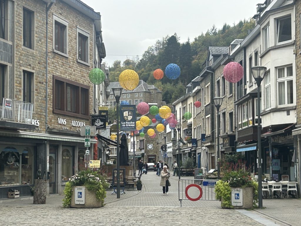
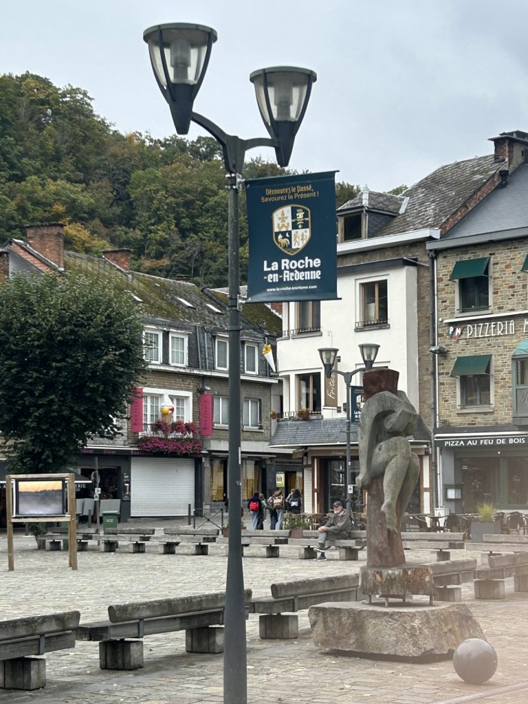
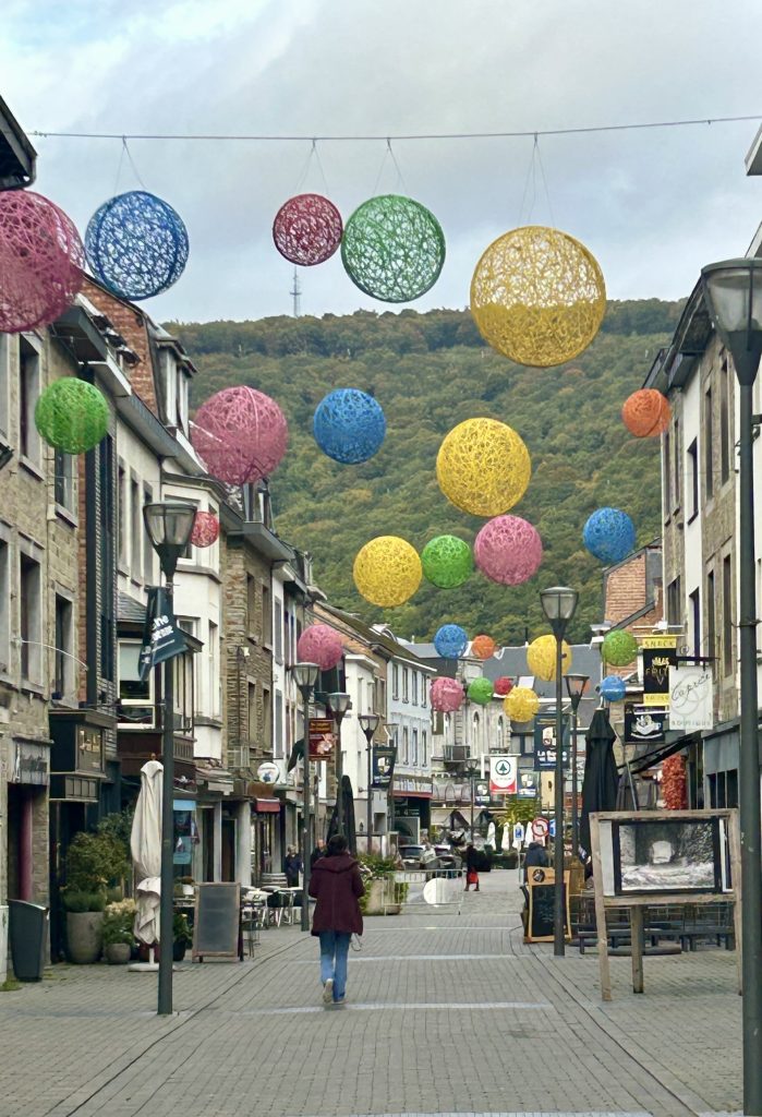
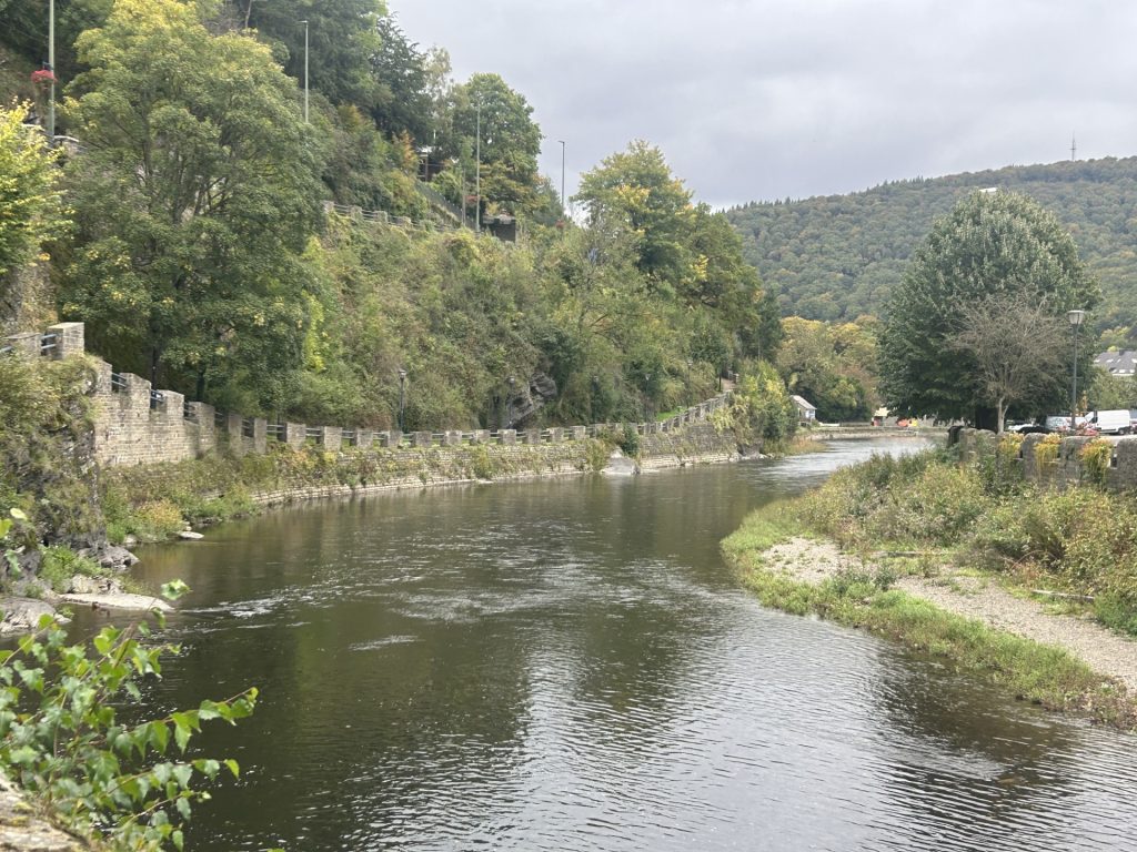
Nestled in a small ravine on the banks of the River Ourthe and surrounded by the Ardenne Forest, La Roche is a picturesque little town some 17 miles south east of Durbuy. It is sometimes described as a hidden gem but, that cannot be true given it is one of the most popular tourist destinations in the Ardennes. The town’s principal features are it’s castle ruins, church, ‘Battle of the Bulge’ museum and a small wildlife park but it is it’s setting on the river in this beautiful part of Belgium which makes it special.
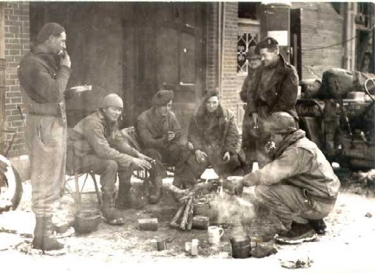
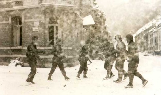
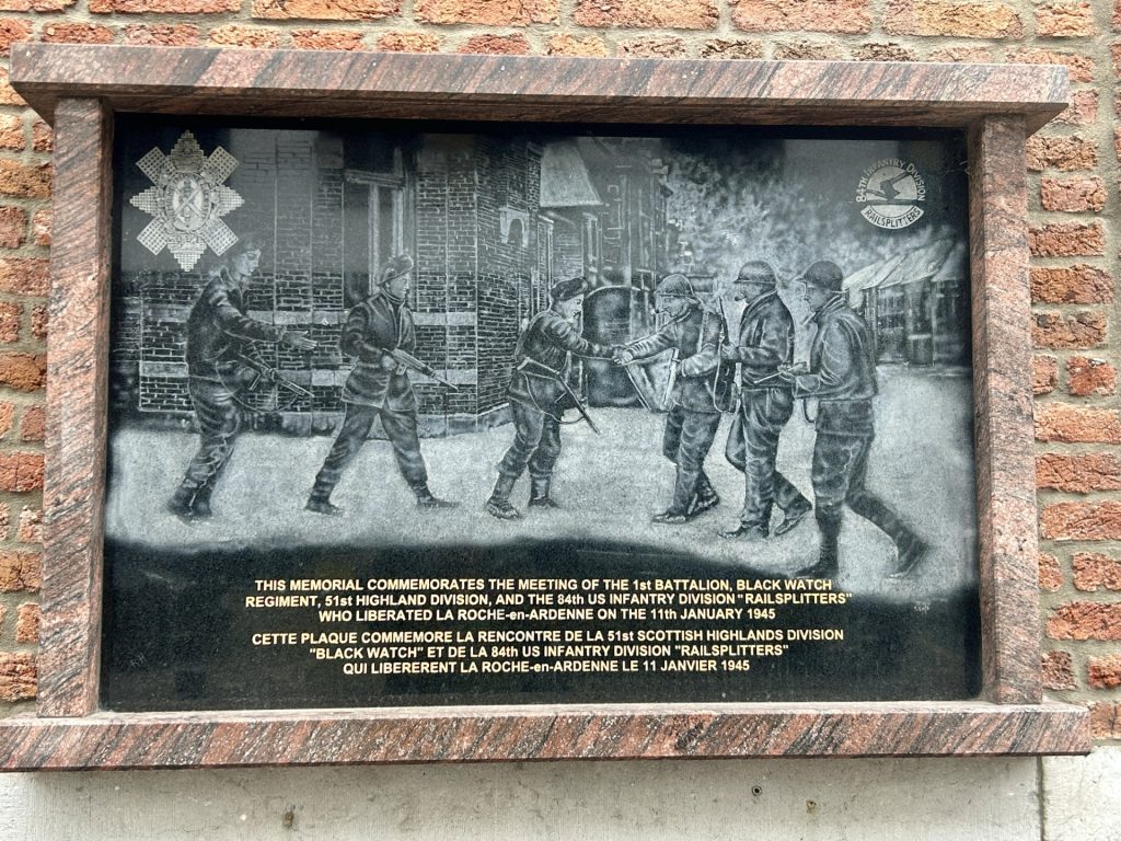
The small privately owned museum in the centre of the town belonging to Michel Bouillon and his son Gilles is well worth visiting because seeing La Roche en Ardenne now, it is hard to believe the town was almost completely destroyed during World War II. Their incredible collection of wartime artefacts help explain how the town had been reclaimed from the Germans in September 1944 but was again under threat on 16 December 1944 when Hitler’s armies launched the ‘Wacht am Rhein’ offensive through the Ardennes. As this attack grew into the ‘Battle of the Bulge’, the embattled US troops retreated from the town; calling in bombers as they did so to slow the German advance by destroying a Bailey Bridge they had constructed over the Ourthe. The 9th US Air Force bombed the town for 7 consecutive days but succeeded only in destroying 90% of the town’s buildings and killing 114 of the townsfolk. The bridge remained intact and the Germans reoccupied the town until being evicted on 11 January 1945 by British groundforces of the 51st Highland Division. Troops of the 84th US Infantry Division arrived shortly thereafter and, later still, a photographer turned up. Seeing British and US troops together the photographer recognised that the ‘Bulge’ had been closed and staged a photo of the allied troops meeting in La Roche. This photo was later used to produce a commemorative plaque in the town…
First photo of British & US troops Second ‘staged’ photo…… and resulting plaque in the town.
Most of the old town and all the houses along the banks of the river were totally destroyed during the Battle of the Bulge and had to be completely rebuilt. Reconstruction started almost immediately after the war but even now the town is only a third of it’s pre-war size.
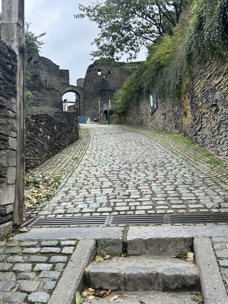
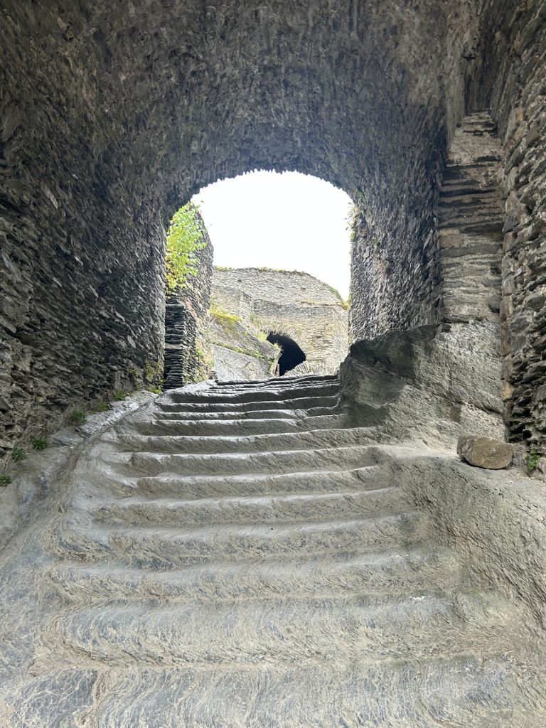
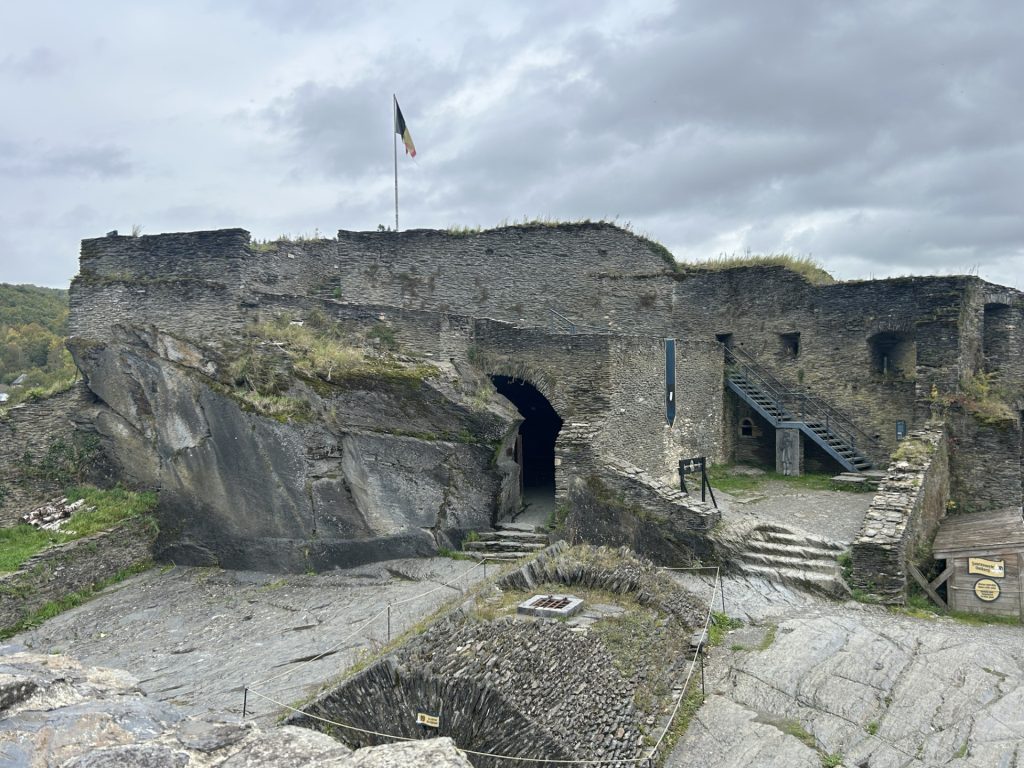
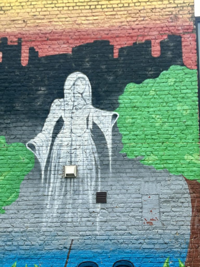
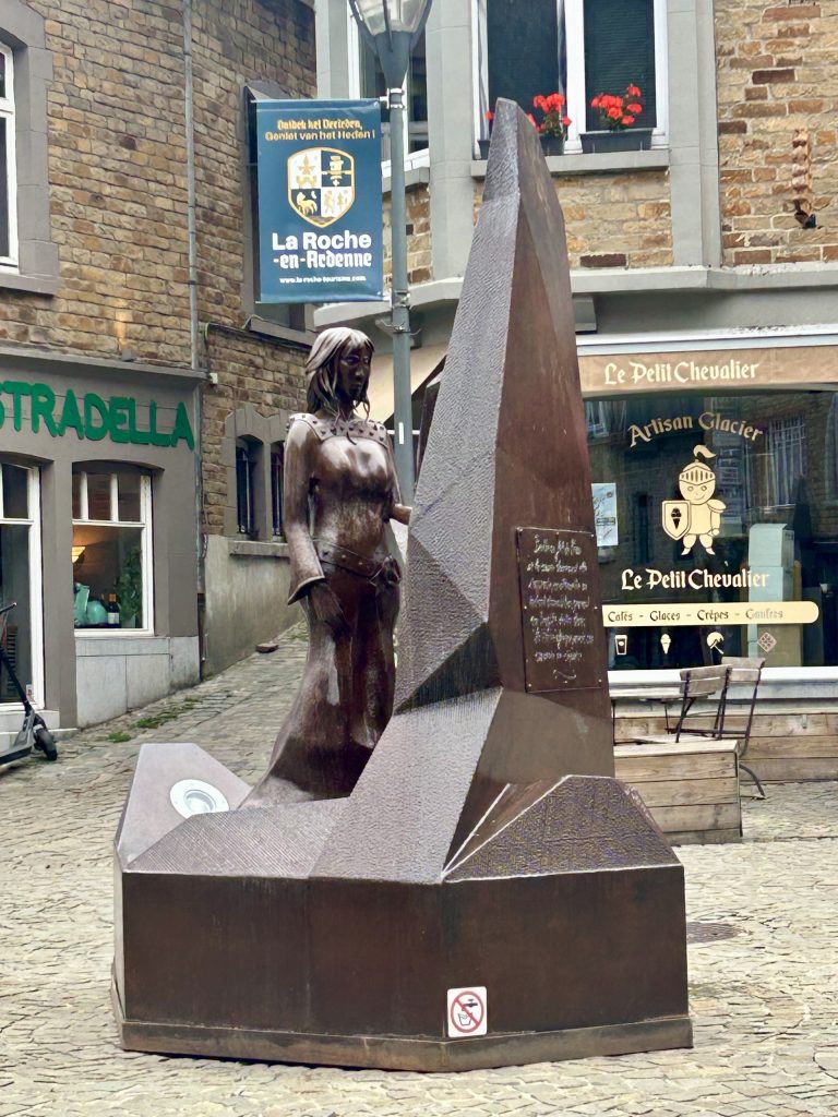
The once imposing 9th century feudal castle which was occupied up until the end of the 18th century was deemed irreparable although in recent years steps have since been taken to make good what is left and it is worth a walk up to the ruins for the good views both across the town and along the River Ourthe. The castle is supposedly haunted by a 9th century countess, Bertold of La Roche. Wanting to marry her off, Bertold’s father organised a jousting tournament where the winner was promised the Countess as his bride. The young woman’s favourite was killed during the tournament and she was compelled to marry the tournaament champion. Inconsolable, she was found dead the following morning and it is believed her ghost haunts the castle ruins to this day.
Castle ruin dominates the townThe walk up to…… and into the castle.There’s not a great deal to the castle…… but the views over the town…… and beyond are impressive.
Of course I don’t believe in this particular ghost but the story serves to introduce some rather splendid street art and an intriguing statue in the town centre (in front of the town hall) which I assume are representations of the Countess Bertold…
The town’s primary church in the centre of the old town, L’Eglise Saint Nicholas, is also worth a visit. There’s much of interest inside the church, especially in terms of paintings and small statues but; it is the church organs (there are three) and the modern stained glass windows with their colourful abstract patterns which most impress. Built between 1899 and 1901 it is not an old church but it too suffered extensive damage during the Battle of the Bulge and had to be repaired later in the 1940’s. The largest of the three organs was installed as recently as 2008 and the stained glass windows in 1980.
Descending from the castle towars the churchL’Eglise Saint Nicolas…… beautiful
Most of La Roche’s bars, restaurants and shops are on Rue Chamont in what was the old town centre but there are others across the river on the Place du Bronze. Indeed, we enjoyed a very good Chinese meal at La Chine, just over the bridge. I’ll finish with some photos…
Apologies, we’ve long since returned to the UK from Tour 12 and I’m still playing catch up with the blog.
We were on our way back to the UK but had a few days before our scheduled ferry departure from Calais. We decided upon a couple of days in a hotel and Vanya found a small privately owned hotel in Heusweiler some 3 to 4 hours drive from Frickenhausen am Main and in the general direction of Calais. There is nothing wrong with the hotel Vanya chose for us (Hotel L’Adresse). It suited our needs and the management and staff were most welcoming but; Heusweiler proved a real disappointment. Heusweiler is not a large town and we didn’t expect much of the place but almost everything there was closed. Without realising it, we had arrived on a German National Holiday. It was German Reunification Day and, to make matters worse (at least for us), the nearby town of Saarbrucken (the capital of Saarland) was taking it’s turn, as the 2025 holder of the rotating presidency of the Bundesrat, to host the country’s annual celebrations of the Berlin Wall coming down on 9 November 1989*. Saarbrucken was holding a party and just about everybody in Heusweiler had closed up and gone there for the weekend. In hindsight we should perhaps have joined the rest of the town and caught a train to Saarbrucken but, in our defence, we didn’t arrive in Heusweiler until late in the afternoon.
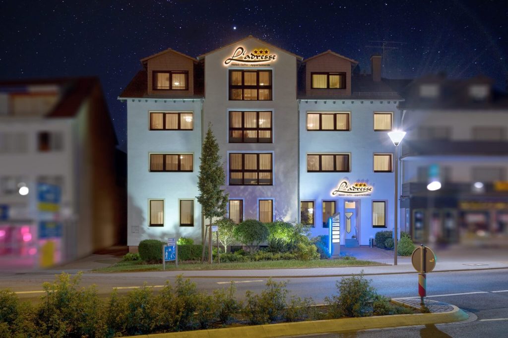
L’Adresse…
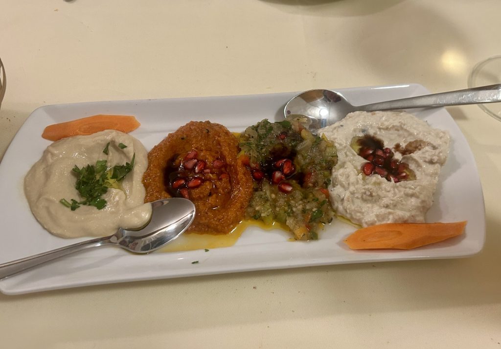
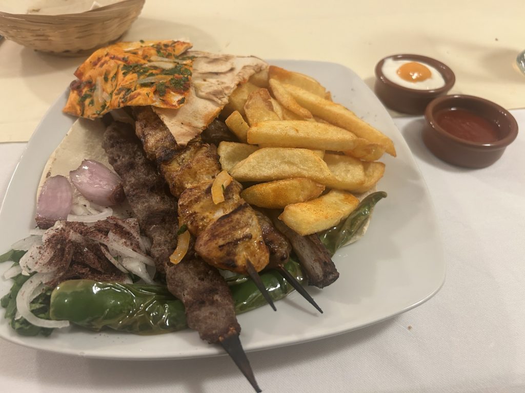
Instead, I wandered Heusweiler looking for a restaurant which could feed us that first evening and, while it took a while to find somewhere open and not already fully booked, we struck lucky with Restaurant Herrgottswinkel. Until about a year ago this was a traditional German restaurant and it still very much looks the part. It was taken over by a Syrian family whose focus is more towards Arabic cuisine. I have long considered Lebanon to be the home of the best Arabic food (and I treasure the memories of our last visit to Beirut and Byblos in 2016) but, this place ranks up there with some of the best Arabic food we have eaten anywhere. They produced a wonderful mezze of Hummus, Baba Ganoush, Muhammara and Muttabel and followed it up with a delicious Kebab dish.
Exploring Heusweiler the next day took no time at all. There’s very little to see and what there is was mostly closed. Moreover, it rained nearly the whole day. I was able to access the entrance hall of an old church, the Pfarreienge Meinschaft, but that porch was about as far as I could get and; I tried numerous times, without success, to access the Pfarrkirche Saint-Josef (opposite the Herrgottswinkel). For my part, that’s all there is to say about Heusweiler.
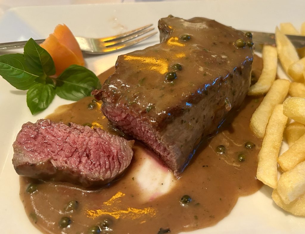
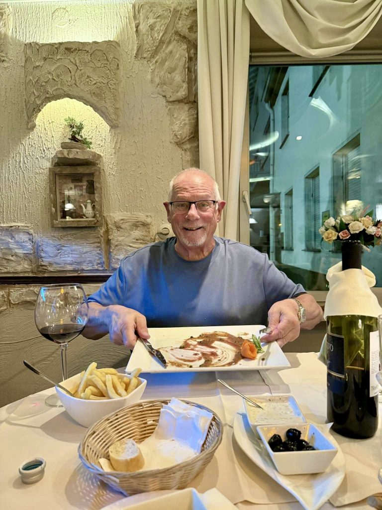
Well, that’s not altogether true. I’d passed the Da Tano Italian Restaurant while roaming the town and reserved a table for the evening. The restaurant is owned by an Albanian family and that evening we were met with a warm and friendly welcome and served some of the best Italian food I have ever eaten. The rump steak (in a pepper sauce) had a rich, beefy taste and was cooked to perfection and; it came with a bottle of the smoothest of Primitivo’s. Life is full of pleasant surprises.
That steak… wonderful.And there’s the proof.
Next stop is somewhere in Luxembourg. We’ve found a vet who will sort our dogs in readiness for the return to the UK.
* NB The Berlin Wall was brought down during the night of 9 November 1989 but the Unification Treaty which officially reunited East and West Germany wasn’t concluded until 3 October 1990. Consieration was given to making 9 November the unification date but, with Kristallnacht having taken place on that same night in 1938, 3 October was deemed more appropriate.
Apologies, we’ve long since returned to the UK from Tour 12 and I’m still playing catch up with the blog.
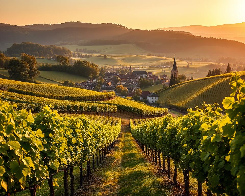
In a previous blog (see Ochsenfurt) I suggested Franconia is as much about beer as wine although I’m not certain many people from Frickenhausen will agree with me on that point. In this charming little village, one of the oldest in Lower Franconia, wine has long been a passion and I suspect beer comes a poor second. The whole area is a natural paradise; a dreamland of sorts with some of the most picturesque vineyard scenery to be found anywhere in Germany. Numerous tiny vineyards are clustered along the gently rolling hills that line the River Main as it threads it’s way through lower Franconia and among them are various chocolate box villages such as Frickenhausen am Main. I took many photographs during our visit but none capture the natural beauty of the area quite like the one below which I found on a travel site (bayern-reise.com). It’s surreal, almost magical…
Talking of photographs, there’s a well maintained cycle path to the front of Frickenhausen which stretches some 30 kilometres along the north bank of the Main and should provide some fine photo opportunities of both the river and surrounding countryside. However, that is one for the future because during this visit I was of a mind to explore the village and then take a short hike up, into and around the local vineyards.
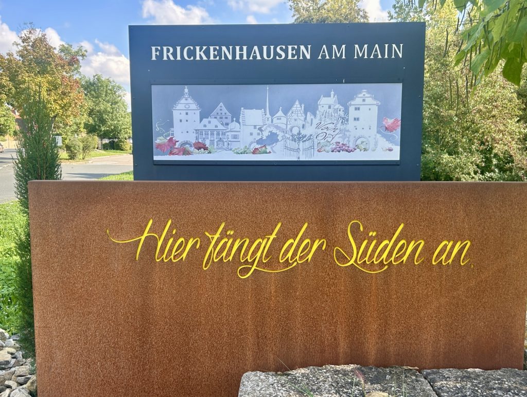
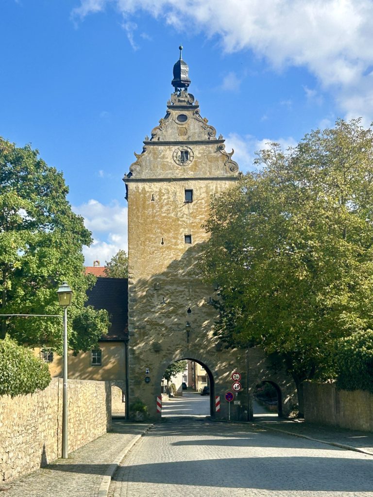
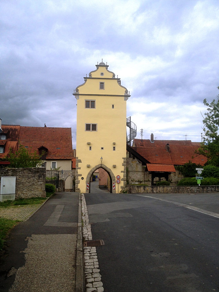
I entered Frickenhausen, which remains surrounded by perfectly preserved 15th and 16th century walls, through it’s lower main gate (the Unteres Tor). This is the most westerly of four gates into the village the others being the Oberes, the Muhltor and the Maintor. There’s also an impressive round tower built into the walls (the Joachimsturm) although access to that tower is limited to members of the local wine growers association on account of their having acquired it as a meeting place.
At the village entrance… “The South begins here”Unteres TorMuhl TorOberes TorJoachimsturm
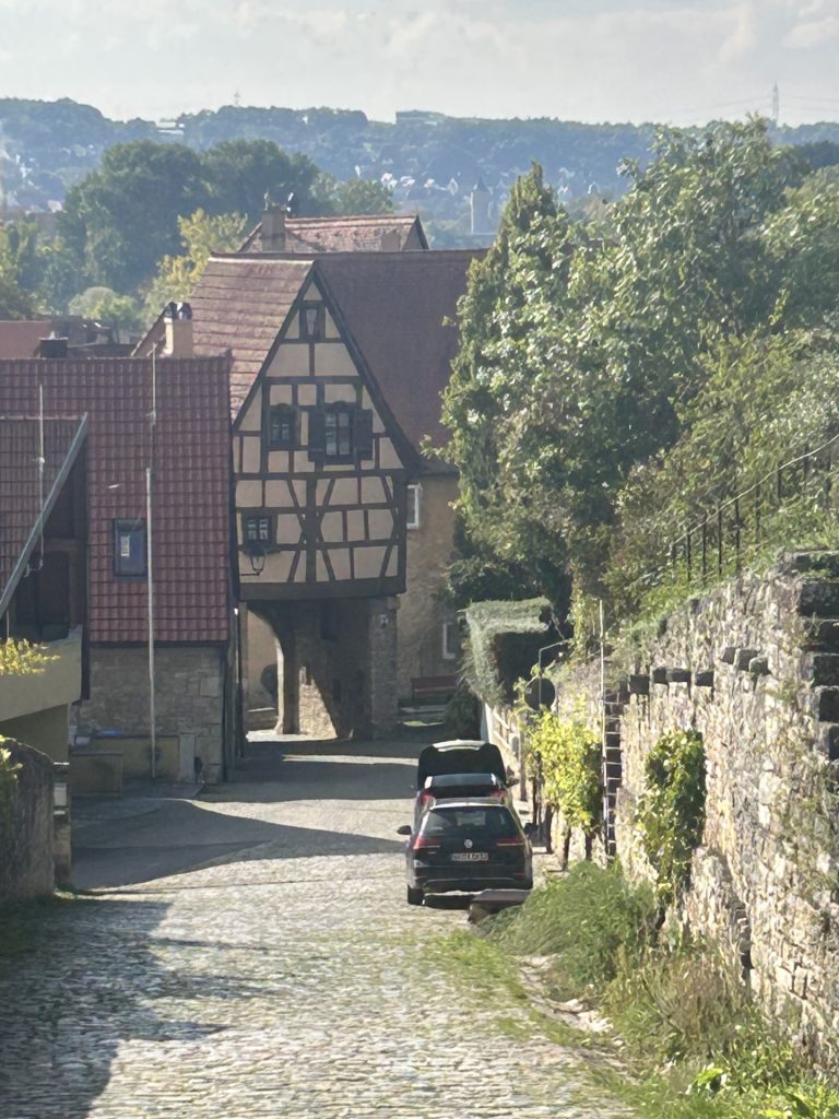
With just over 1,200 inhabitants Frickenhausen is a small village but inside it’s walls there is a much to suggest this place was once an important and very rich town. Sold by the Prince-Bishops of Wurzburg to the Wurzburg Cathedral Chapter in 1406, it was under the latter’s tenure that the town gates and surrounding walls, together with many of the older buildings, were constructed but; there is much about Frickenhausen which attests to the town’s continuing success until well into the 19th century. One only has to look at the number of beautiful stately half timbered town houses to be found on Babenbergplatz and along the village’s principal streets (the Hauptstrasse, Fischergasse and Muhlgasse). Most were built between the 17th and 19th centuries.
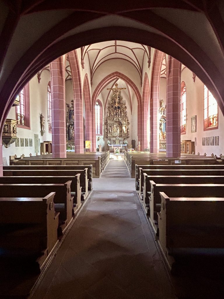
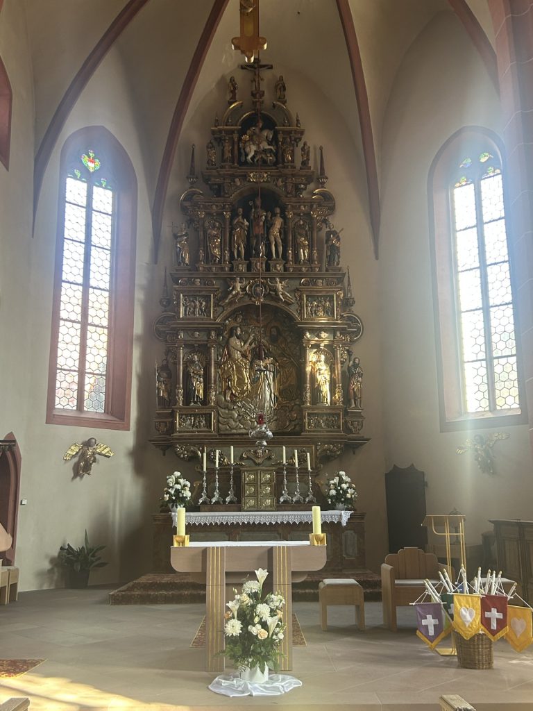
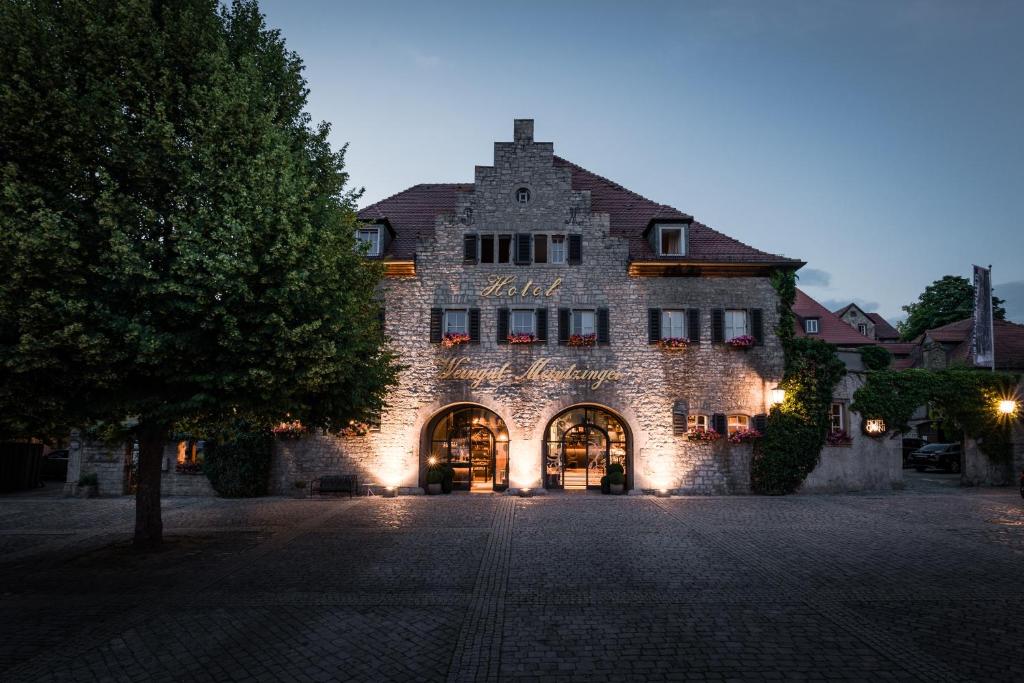
Of the other buildings in the village/town, those which stand out are the Roman Catholic Parish Church of Saint Gallus; the two story Town Hall complex (which has been extended over the years since it was first gifted to the town in 1476); the Schwarzenberg Palace, the Marian Column (next to the Town Hall) and an old village fountain. My favourite is the church which, most unusually, has a small World War II cemetery outside but; special mention should perhaps also be made of the huge 14th century wine cellar built by the Wurzburg Cathedral Chapter. It has long been owned by the Meintzinger Family (i.e. since the 18th century) and much of it is still used by Meintzinger to produce and store wine but parts of it have been converted into an elegant boutique hotel… and what a hotel! Dogs are not allowed or we’d have booked into the hotel like a shot. I had a quick look inside and it’s terrific.
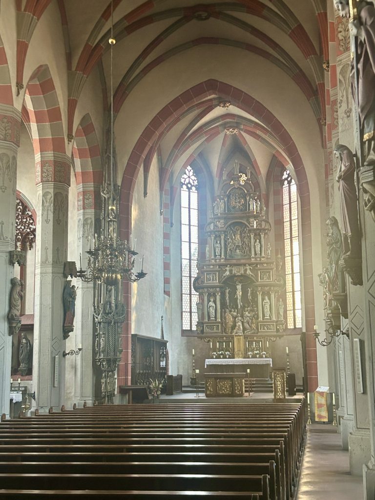
The Town Hall Complex. Sankt Gallus is behind it.Inside Sankt Gallus…… and the altar.On display in the church…… an outside, Lest We Forget.Schwarzenberg PalaceMeintzinger Hotel
There are two gates at the eastern end of the village. The larger of these is the Muhltor which leaves Frickenhausen via the Muhlgasse and follows the Main to Marktbreit. The smaller gate is the Oberes Tor which leaves the village by the Frankischer Marienweg and along what is sometimes called the Kapellensteige on account of this particular exit leading up through the Kapellenberg Vineyard to the Saint Valentine Chapel and, beyond the chapel, to the “terroir f Frickenhausen”. It’s not a particularly steep walk up to ‘terroir f’ but it’s different and worth doing for the views alone.
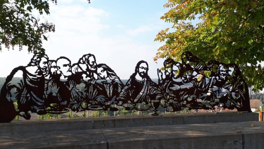
There are a number of recognised trails through the vineyards surrounding Frickenhausen but one of the more interesting is the ‘Wine and Bible Walk’ up to ‘terroir f’. I should explain that the terroir f initiative constitutes a collection of sites across Franconia, each with a different theme, which are intended to entice tourists into the vineyards so as to educate them in some aspect or another of viticulture. Frickenhausen selected the connection between wine and religion as a theme. Wine has long been honoured in some way, shape or form by many of the world’s religions. Even the Quran describes wine as a “good gift of creation” (to be imbibed in the hereafter if not on earth). There are plenty of examples along the walk to ‘terroir f Frickenhausen’ as to how Christianity has celebrated wine over the years and the terroir f exhibit itself (at the top of the hill a little way beyond the Saint Valentin Chapel) comprises a steel template of Leonardo da Vinci’s Last Supper mounted on a series of large limestone blocks. The Last Supper, of course, gave rise to the Eucharist with it’s sacramental bread and wine. Whatever one’s religion, ‘terroir f Frickenhausen’ makes for a magnificent viewpoint and I’m advised too that on occasion it is used for wine tastings. Different or what?!?
Terroir f Frickenhausen
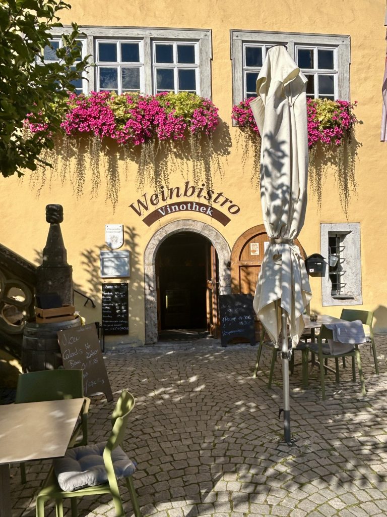
Continuing with the wine theme, Vanya and I enjoyed a late afternoon wine tasting session back at our camp site which was organised by the camp site management. We learned something about the local grape varieties (Gruner Silvaner, Muller-Thurgau and Bacchus); bought a few bottles of ‘Silvaner’ and; after a fine meal in the camp site restaurant, returned to the village in the evening to put our learning to the test. I’d picked out the Winebistro Vinothek, on the ground floor of the town hall complex, as an ideal place to test ourselves… and so it proved. They were most welcoming and produced an outstanding Riesling. In fact, the whole wine tasting experience in Frickenhausen surprised us with Vanya who, up until then, would only drink Weisser Burgunder (and that would have to be from a Bocksbeutel) really enjoying both the local Silvaner and the local Riesling. It seems to me that Frickenhausen’s passion for wine is tangible and infectious.
We really enjoyed Frickenhausen am Main and would have stayed on but we were on our way back to the UK and to that end had booked a hotel further west in Saarland. We had to move on but we’ll definitely return. I think also this is an excellent place from which to visit some other attractive towns and villages in the area – Sommerhausen, Marktbreit, Kitzingen, Volkach and, further afield in Baden Wurttemberg, there’s Bad Mergentheim.
Until then, I’ll leave you with a thought – “Wine improves with age. The older I get, the better I like it.” – That’s Anonymous but it does fit.
We first visited Franconia during Tour 8 (in 2023) and a number of visits since has seen the region become a firm favourite of ours. This stay was a short one; just two days in Lower Franconia exploring the small town of Ochsenfurt and it’s tiny neighbour Frickenhausen Am Main. Ochsenfurt (that’s Oxford in English) sits on the left bank of the River Main some 12 miles south east of Wurzburg while Frickenhausen is a village on the right bank of the river, just a mile east of Ochsenfurt.
We had checked into an outstanding camp site (Knaus Campingpark) which is within easy walking distance of both Ochsenfurt and Frickenhausen and over the two days had sufficient time to properly acquaint ourselves with both places.
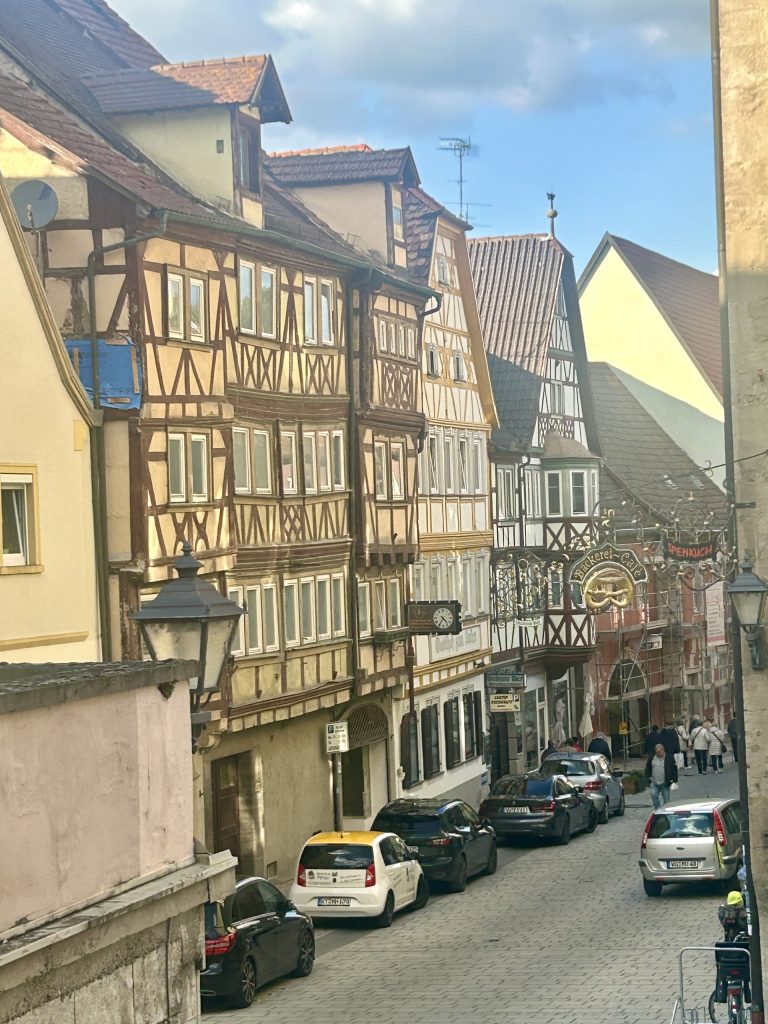
We started with Ochsenfurt, a small picturesque town with a little over 11,000 inhabitants. In medieval times the town would most likely have been graded as a city as it was completely surrounded by walls. Much of the walls, together with the original town gates and towers, still stand. Ochsenfurt also had a small castle but; there’s little left of that these days and what there is now serves as a tiny history museum. Inside the walls is a compact town centre of narrow streets and several colourful, well preserved, half timbered buildings; the best examples of which are on the Hauptstrasse and date from between the 16th and 18th centuries.
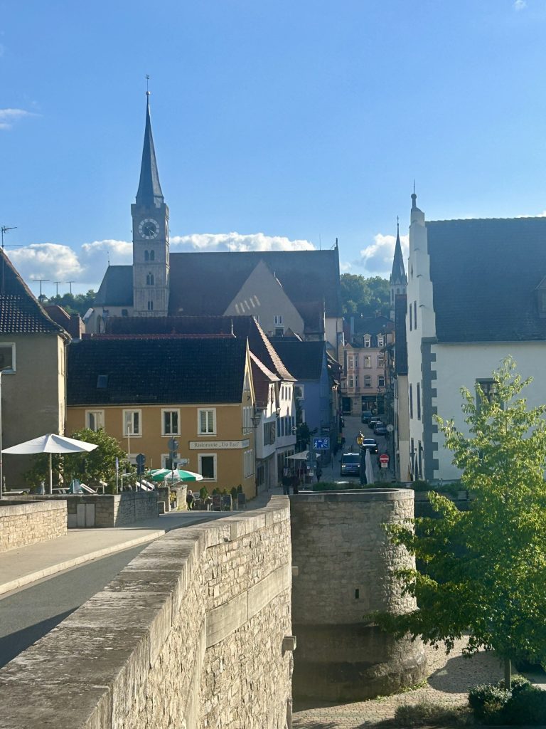
Frankischer Marienweg Bridge
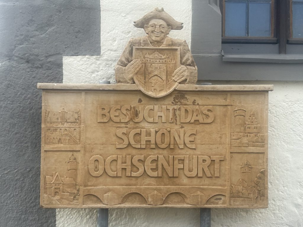
Cross the Main using the Frankischer Marienweg Bridge and you’ll arrive on Bruckenstrasse. The first building to the right of this street is the history museum, known locally as the ‘Schlosschen’ (or ‘Little Castle’) although it’s proper name is the Heimaatmuseum. It is almost all that is left of the old castle and is easily recognised by a stone carving on it’s front inviting you to ‘Visit Beautiful Ochsenfurt’.
Bruckenstrasse‘Visit Beautiful Ochsenfurt’
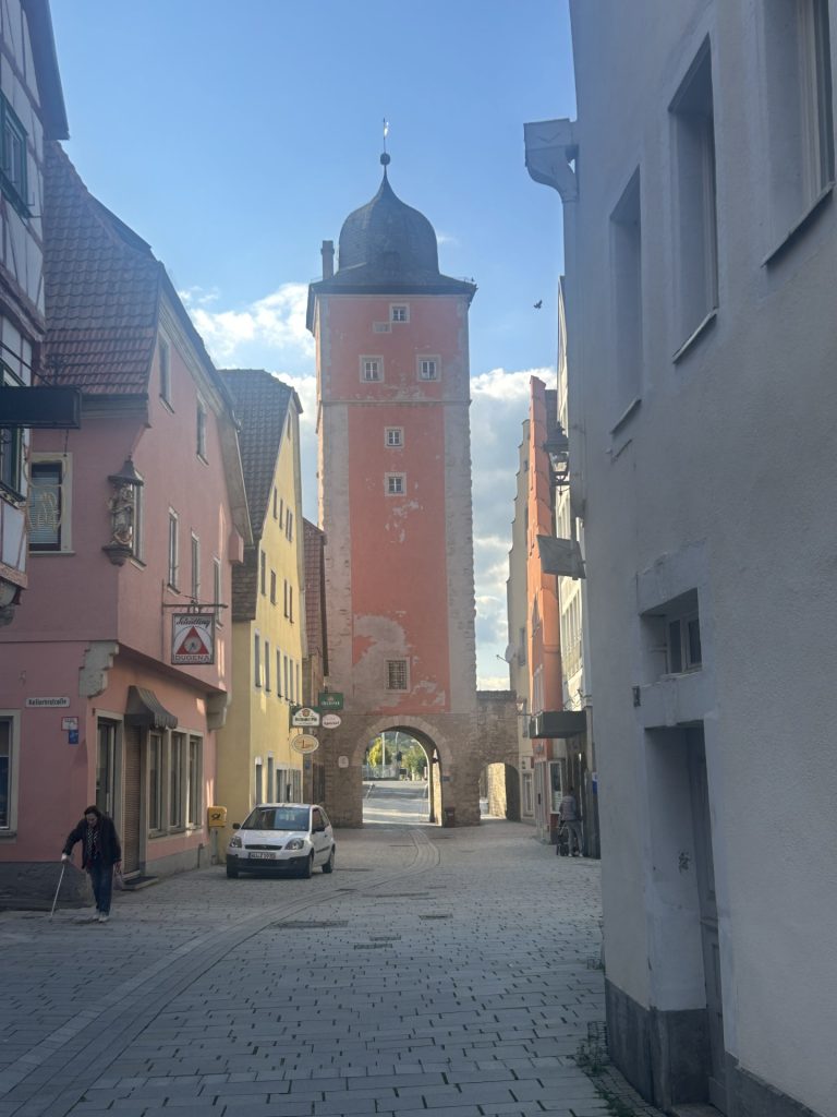
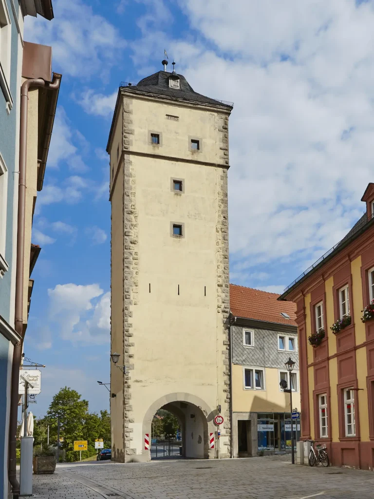
Walk the length of Bruckenstrasse and you’ll soon reach the Hauptstrasse which is Ochsenfurt’s high street and very much the centre of the medieval Old Town (die Alte Stadt). Stretching from the Klingentorturm in the west to the Oberes Tor in the east, the Hauptstrasse runs the length of the Alte Stadt. It’s no longer the largest street in Ochsenfurt but it is certainly the prettiest with it’s rows of half timbered buildings, an unusual water feature (not unlike a small “Bachle”), the Roman Catholic Church of St Andreas or St Andrew’s, and no less than two 15th century town halls. Oh…and there’s plenty of interesting boutique shops and cafe bars to be found on either of Bruckenstrasse or the Hauptstrasse.
KlingentorOberes TorAnd the Hauptstrasse…… with an unusual water feature…
The large red building near the far end of the Hauptstrasse is the Rathaus (town hall). Built in 1497 it is actually known as the ‘new’ town hall. The older town hall, on the corner of Bruckenstrasse and Hauptstrasse, isn’t much older but it was deemed too small and now houses the town library and a small cafe. The new town hall is easily recognised by it’s colour and it’s intricate clock tower. The tower comes to life every hour on the hour with the skeleton moving, the oxen bumping their heads together and some of the windows opening to reveal the faces of councillors looking out over the town. The show is all too brief but still impressive.
…and the Rathaus in the background…… with it’s unique clock towerThere’s a local market in front of the Rathaus every Saturday
Also on the Hauptstrasse is the Roman Catholic Church of Saint Andreas (Saint Andrew’s in English), parts of which date back to the late 13th century. It’s big and impressive and towers over every other building in the old town. A couple of chaps started practising on the church organ while I was there and, I don’t know what music they were playing but, the rich resonant tones of the organ filled the church with such grandeur and joy. I’d never thought about this before but, all too often, these incredible and often magnificent looking instruments are used to play such sombre or solemn music. What a waste.
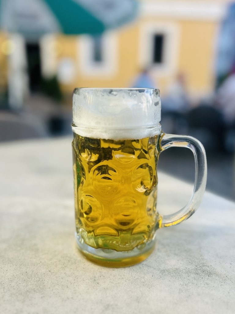
I made two trips into Ochsenfurt that first day. One on my own which ended with a couple of cold beers in a small bar on Bruckenstrasse, opposite the Schlossen. The second was with Vanya (and our dogs) and ended with a wine tasting session back at our camp site. Franconia is renowned for both it’s wines and it’s beers. There are many vineyards in the area but the great majority are on the Frickenhausen side of the Main while the breweries are on the Ochsenfurt side. Indeed, despite it’s small size, Ochsenfurt has two private breweries each of which date back to the 19th century. One is the Privatbrauerei Oechsner (which produces a very good Pils) and the other is the Gehring Brauerie, which beer I have yet to taste. Germany is well known for it’s many beers but few know that the Franconia region has the largest concentration of breweries anywhere in the country.
Oechsner Pils…… followed by a visiting wine tasting session
A word or two about the Knaus camp site we were staying at. There are currently more than 20 Knaus camp sites across Germany. I don’t know whether they are all owned and operated by the same company or if they are simply part of a collective but; from what I have read about them they are all quite unique. They all appear to be of a high standard in terms of facilities, fixtures and fittings but attractions at each camp vary enormously and are often aligned with local interests and/or amenities. Some will appeal more to young families; others to those whose children have grown and flown. We fit more into the latter category (empty nesters) and this particular site on Frickenhauser Strasse appealed to us not least because the friendly and very welcoming management team has formed an association with a local winegrower who happily visits on a daily basis to conduct wine tastings. We loved it and we also liked the onsite restaurant.
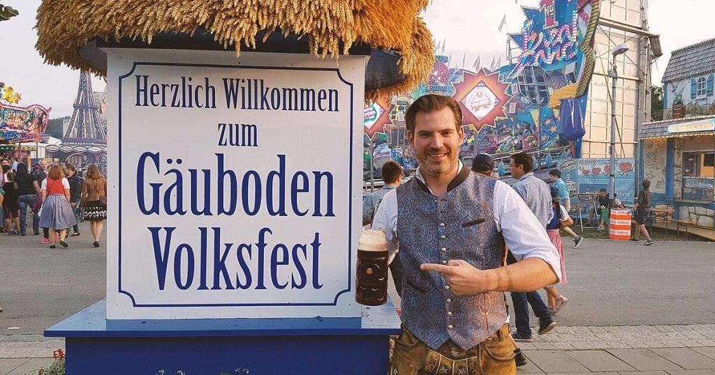
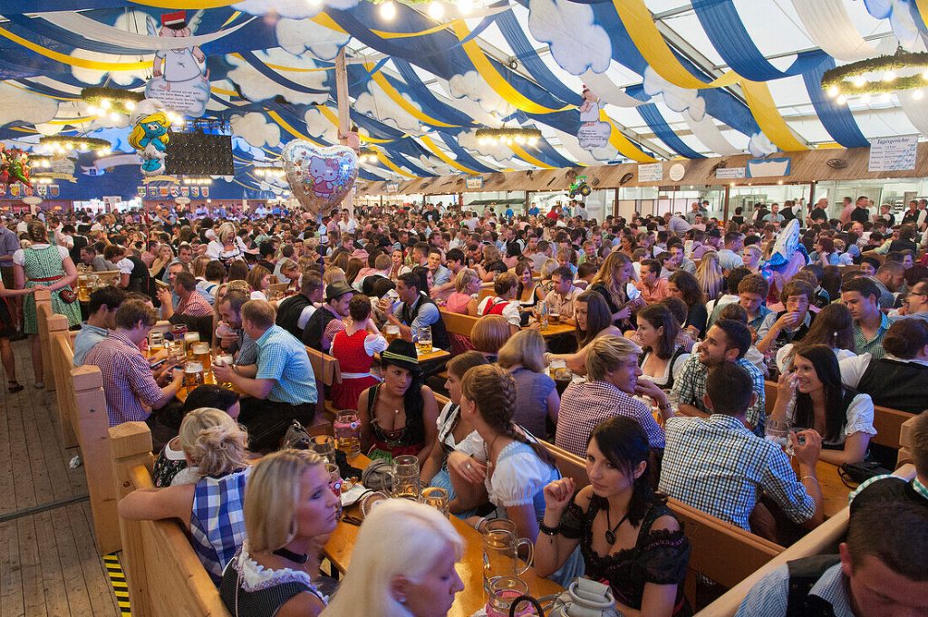
It is said Straubing is a “Beer City” best known for it’s Gäubodenvolksfest; a 10 day beer festival held every August which features specially prepared beers from 7 local breweries. The beers are served across 7 huge festival tents which together can accommodate 27,000 seated guests and so make this beer festival the second largest in Bavaria (after Munich’s Oktoberfest). We missed this year’s Gaubodenvolksfest (not that Vanya would have been particularly interested) but I reproduce below three photos (not mine) which suggest that, going forward, this is a must for me…
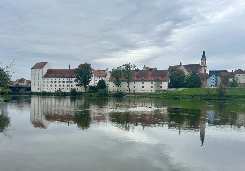
Beer City or not, Straubing is one of the more interesting towns in this part of Germany and well worth a visit. Situated on the banks of the Danube in the east of Bavaria between Regensburg and Passau it is a well preserved historical and picturesque little city where we were quite happy to spend two full days.
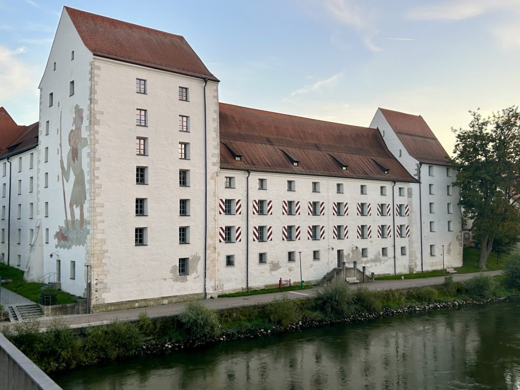
Immediately after settling in at Campingplatz der Stadt der Straubing I went off to explore the city and find a restaurant for the evening. From the campsite it is an easy 10-15 minute walk along a cycle path to the city centre. The path runs parallel with the river through a small wood at the back of the campsite until it reaches the Schlossbrucke. Cross the Danube over this bridge and you’re in the city. In fact, the first building to be encountered is the Herzogsschloss; a Ducal Palace built by Duke Albrecht I during the 14th century. There’s a small museum inside the palace but the building is not always open to the public (probably because it also houses the city’s tax office) but it is possible to visit the inner courtyard. The city centre is almost immediately behind the palace.
Looking across the Danube to the Herzgsschloss
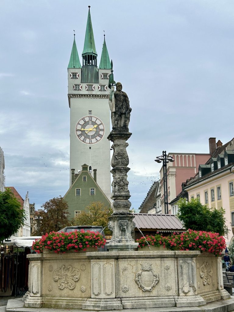
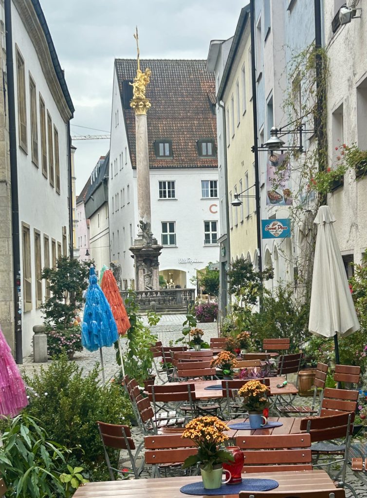
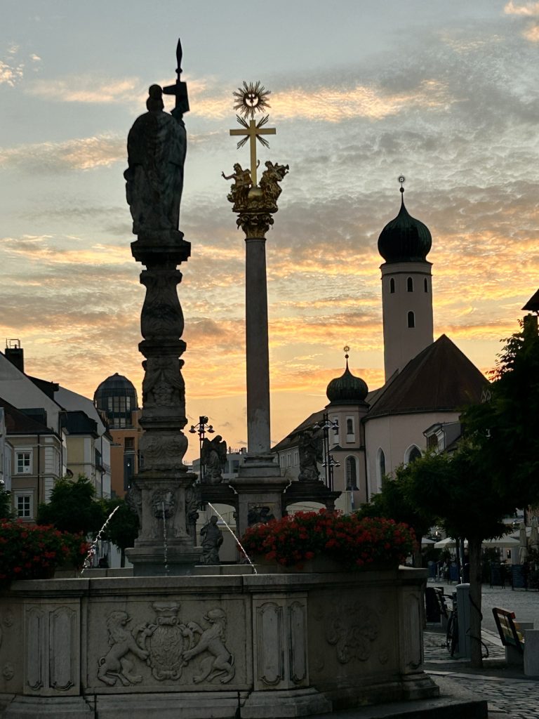
The beating heart of Straubing is it’s spacious mostly pedestrianised Markplatz which is a little way behind the Herzogsschloss. This market place is a good half a mile long and is actually formed by two squares, Ludwigsplatz to the west and Theresienplatz to the east, which are separated by an imposing watchtower (the 68 metre high Stadtturm). Both squares are lined with brightly painted townhouses with steep gables and opulent Baroque and Rococo facades. The ground floors of most of the townhouses have been converted into shops and cafes and, of course, the ubiquitous ice cream parlours – this is, after all, Germany and the Germans favour ice cream as much as the Italians. Other features on the squares include two impressive fountains (the Tibertiusbrunnen on Theresienplatz and the Jacobs Fountain on Ludwigsplatz); the beautiful marble Trinity Column (the Dreifaltigkeitssaule) with it’s gold top and; the Rathaus (city hall).
During the period April to September there are guided tours to the top of the Stadtturm which until 1930 was still occupied by a watchkeeper. The tours take in his rather spartanly furnished apartment. He couldn’t have been very comfortable living in the tower but the views over the city are second to none.
Tibertiusbrunnen & StadtturmSt Jacob’s Fountain & City Water Tower
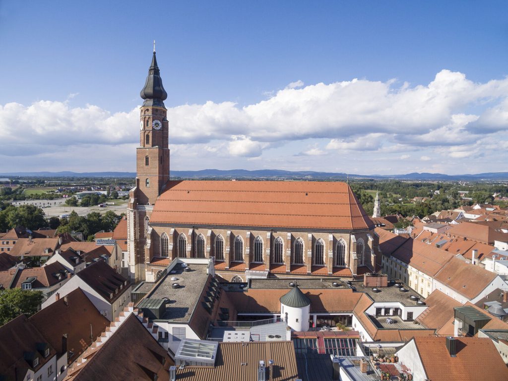
I entered just one church during this visit (the Papal Basilica of Saint James & Saint Tiburtius) and it was getting late in the day when I did that. As a result, many of my photos were rushed and underexposed and I’m therefore relying on just two photos from Straubing’s tourist office website to reflect the building’s grandeur and elegance. The first photograph, of the exterior of the church, appears to have been photographed from the Stadtturm and it depicts a stately and very imposing church which dominates Straubing’s old town. The second photo illustrates how bright and majestic it is inside the church. The Basilica is easily the largest church in the city and while it’s exterior Gothic architectural style can appear dark and somewhat austere, the inside is glorious. In addition to some quite remarkable architecture (highlights of which are the pulpit and some of the many side chapels) and a beautiful 15th century altar taken from a Nuremberg Monastery, there’s a brilliant selection of stained glass windows which includes the “Moses Window” supposedly designed by Albrecht Durer. How I wish I could have made it up into the bell tower.
Papal Basilica of St James & St Tibertius…… and inside.
Straubing is home to a number of magnificent churches, including the 12th century Church of Saint Peter and the 14th/15th century Catholic Church of Saint Vitus or St Veit. There’s also an old Carmelite Church which was sold to the University of Munich in 2018 and, alongside it, another small but impressive church which was part of an Ursuline Convent. Finally, there’s the former Jesuit Church at the top end of Theresienplatz. Few of these churches were open during my visit but I was advised that some of them are as opulent inside as the Papal Basilica. Next time?
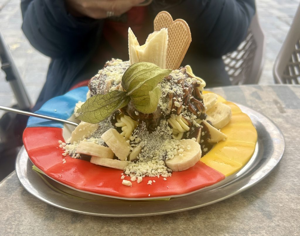
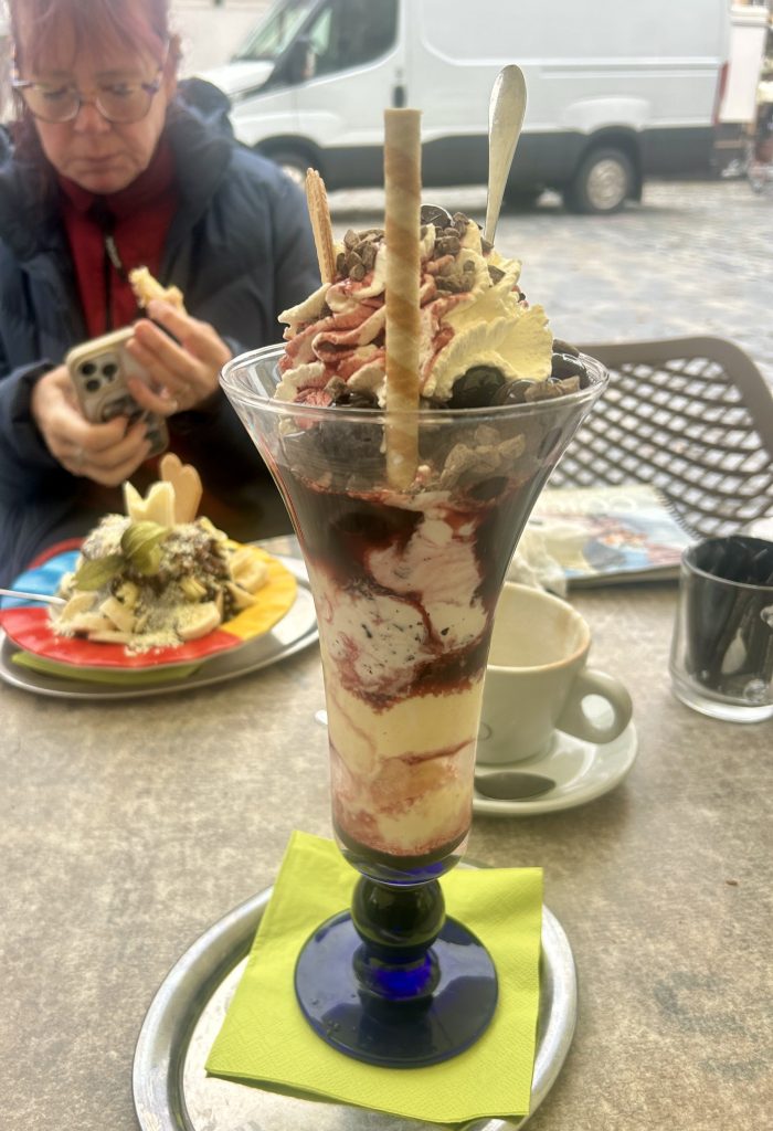
During our two days in Straubing I made no less than four trips into the city and walked many miles (most of them tracking down ‘stolpersteine’) but I also spent a fair time on the Marktplatz; just sitting in the sunshine over a cup of coffee or an ice cream, watching the world go by. People watching is one great pastime although next time I’ll forego the ice cream. How on earth can anyone as small as Vanya eat that much ice cream in one go?
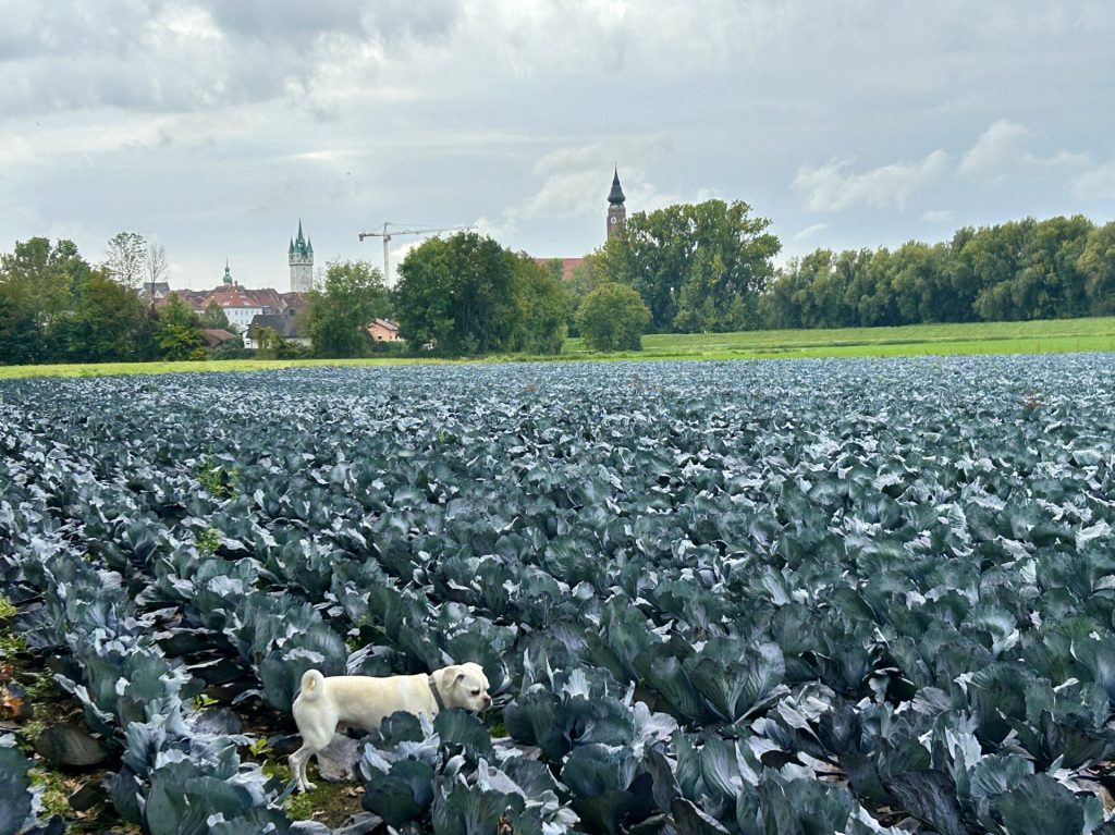
Beanie prefers cabbage patches to city centresBeer Time Vanya’s Banana Eis… …and my Cherry EisThe city entrance known as the Hospital Gate
Another occasional interest of mine, while touring Europe, is research into local history and/or legends. One story I stumbled across in Straubing, and which seems so preposterous one could be forgiven for thinking it a legend, is the tragic but true story of Agnes Bernauer.
It is believed Agnes Bernauer was born the daughter of a bath house attendant or barber in Augsburg around 1410. Being a commoner, little is known about her early life but she grew up to become the beautiful mistress of Albrecht, a son of Duke Ernst I of Bavaria-Munich. The duke grew increasingly unhappy as the couple’s relationship developed and/but was absolutely horrified upon learning they had secretly married each other. Agnes’s social standing was such that no child born of this union could possibly inherit the Dukedom. With the threat to his dynastic succession now very real, the Duke urged his son to put Agnes aside but Albrecht refused. The Duke’s response was to wait until his son was away on a hunting holiday and then have Agnes seized, condemned for witchcraft and executed. She was drowned in the Danube on 12 October 1435 while her husband Albrecht was still away.
Unbelievably the father and son were soon reconciled and, within a year, Albrecht had taken another wife. He married the aristocratic Anna of Brunswick-Grubenhagen and went on to have 10 children and inherit all his father’s titles. It is not known where Agnes’s body is but in 1436 the Duke had a memorial chapel built in the cemetery of the Parish Church of St Peter’s in Straubing (to atone for her murder?) and Albrecht paid for a perpetual mass which continues on an annual basis to this day (and that’s his conscience salved?).
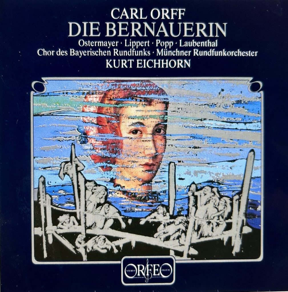
The story would perhaps have died with the drowning of Agnes Bernauer but it somehow survived through the efforts of numerous poets, authors, screenplay writers, musical composers (Carl Orff made it into an opera – Die Bernauerin) and; no less a personage than King Ludwig I of Bavaria (who wrote a poem of his own about the tragedy). It’s future was assured when, in 1935, the city of Straubing decided to hold an Agnes Bernauer Festival every four years. This open air theatre production of the story, staged by 200 amateur actors in front of some 20,000 spectators in the courtyard of the Herzogsschloss, continues to this day.
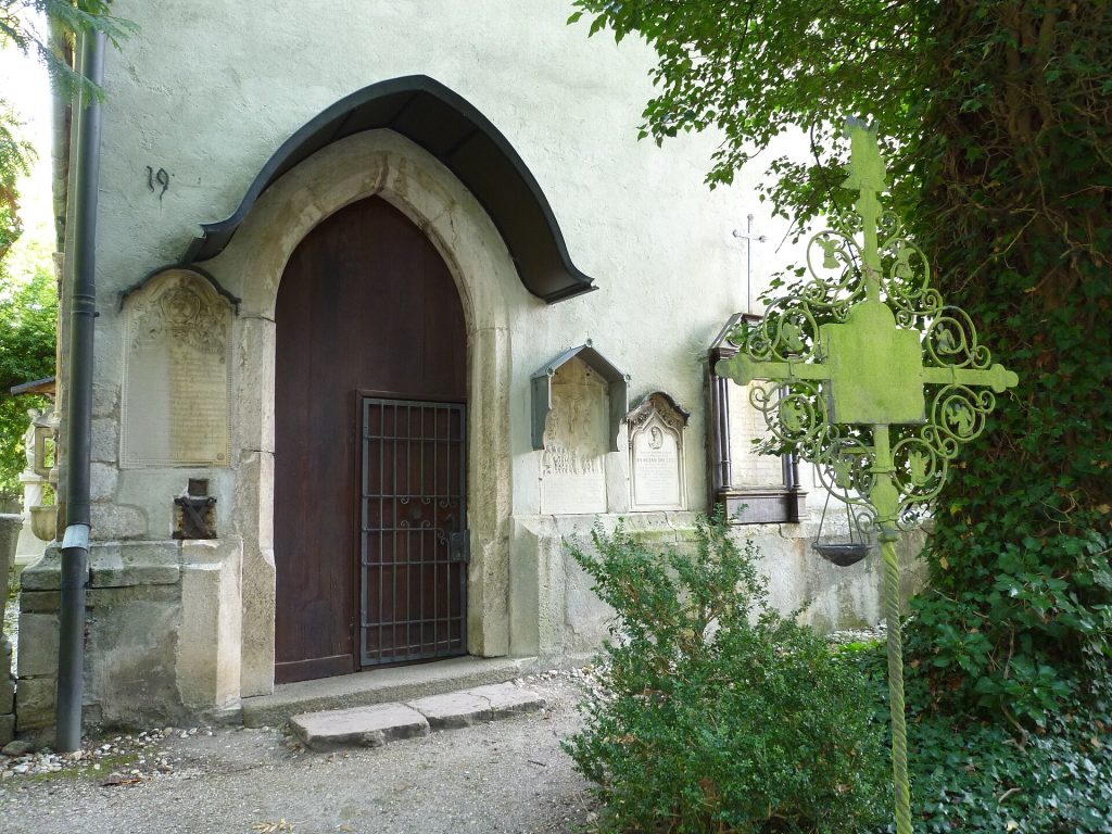
The Agnes Memorial Chapel
Oh… and before I finish (I still have quite a few blog entries to catch up on), the Campingplatz de Stadt on Gstutt Island is great for a stopover. We have no hesitation in recommending this campsite. The restrooms are clean and well maintained and the small onsite restaurant-bar, which specialises in home cooked Vietnamese cuisine is excellent.
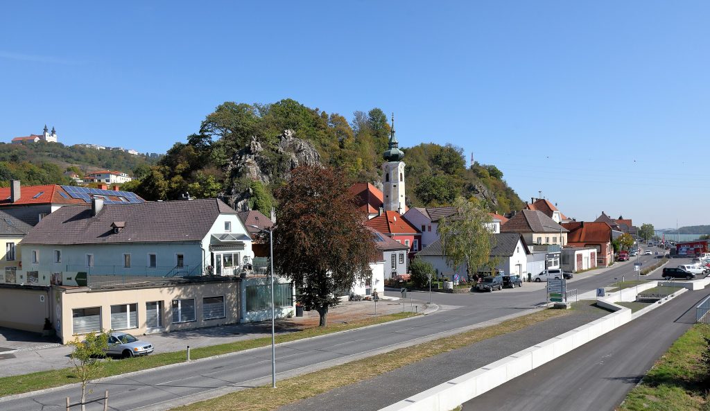
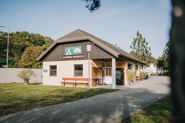
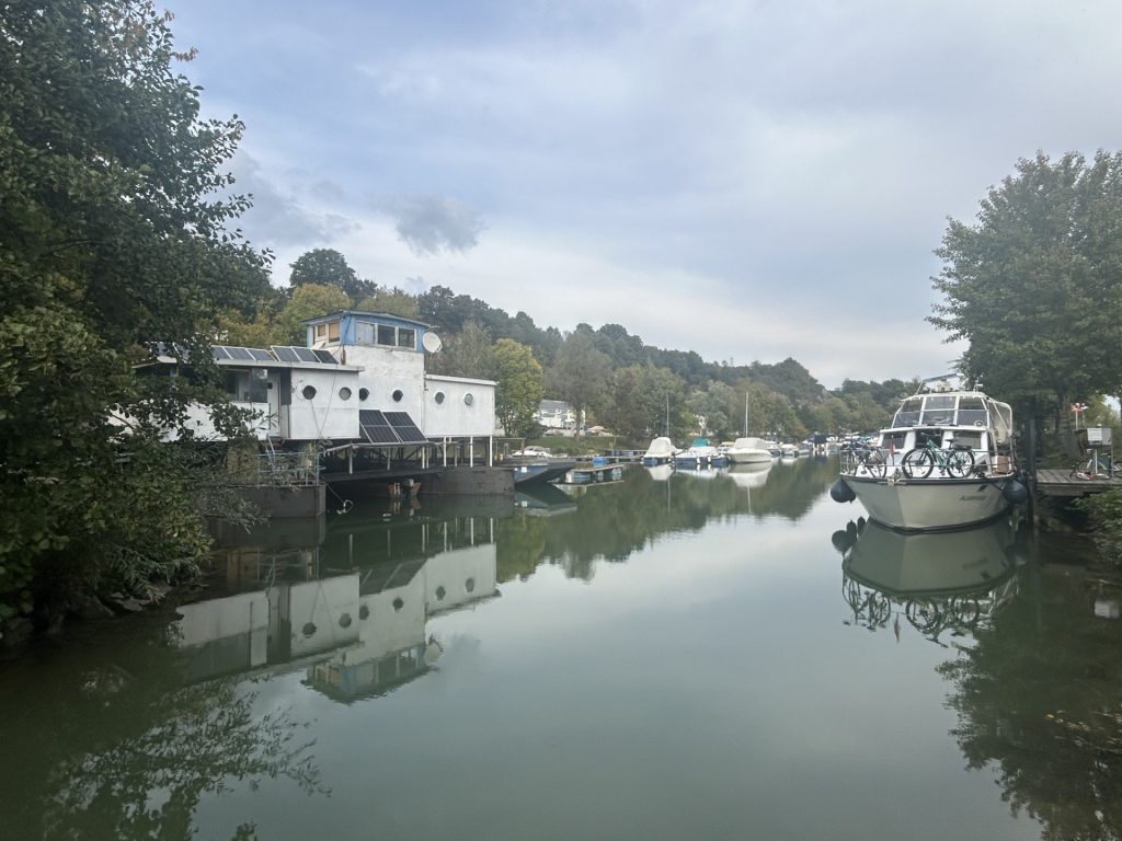
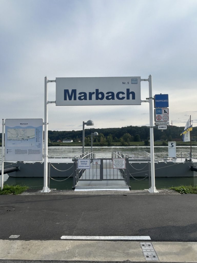
We were on our way back to the UK, albeit slowly, and decided to overnight somewhere on the Danube before crossing into Germany. The tiny market town of Marbach an der Donau on the left bank of the Danube less than 10 miles east of Ybbs suited us perfectly not least because it has a very tidy little campsite directly on the banks of the river (Camping Marbacher).
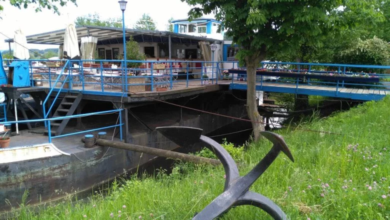
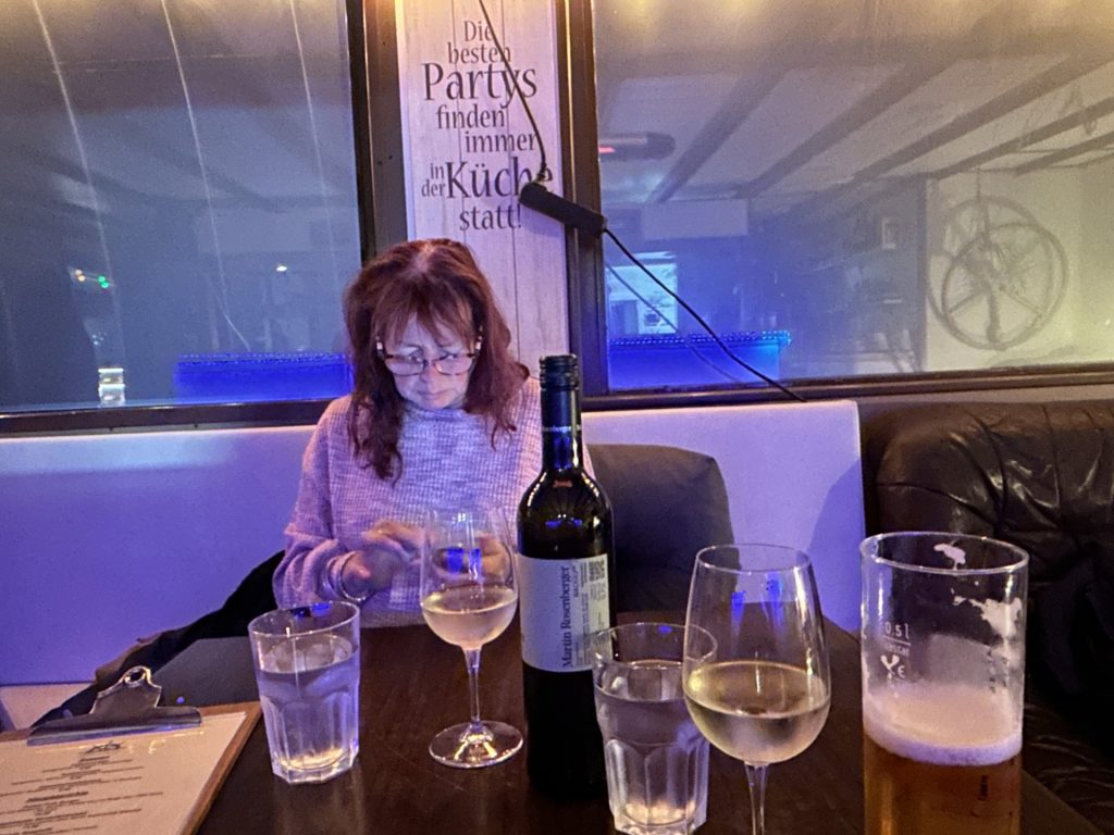
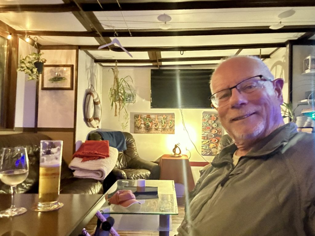
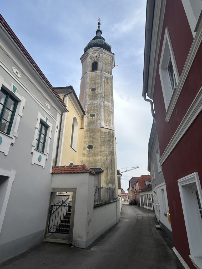
There’s not a great deal to Marbach but much of what there is (the town hall, a church, a few shops and restaurant-bars) is on Marktstrasse which runs parallel with the B3 (the main road through the town). One exception to this is the ‘Zur Alte Fahre’, a local bar-restaurant which sits on a large barge in the town’s small harbour close to the camp site. The bar looks a bit tatty (it’s old) but don’t let that put you off. The welcome was warm and friendly; the tiny indoor restaurant area was clean and cosy and; the food was great.
Marbach an der DonauCamping MarbacherThe Marina…… and the ‘Zur Alte Fahre’…Studying the wine list…… and chillingThe pierSt Martinskirche on Marktstrasse
We only stayed the one night but I’d visit again. This is a very pretty part of Austria with plenty to see.