Of all the places along Spain’s eastern coastline, the one I have most wanted to see is the Cap de Creus and now, I’ve seen it.
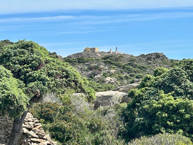
We drove to Cadaques for a couple of days and that allowed me one full day to wander the Cap de Creus. The Cap de Creus is a nature park and marine reserve which opened in 1996 and almost fills a small peninsula on the north coast of Catalonia. At it’s western end it stretches between the two small resort towns of El Port de la Selva in the north and Roses in the south. It’s most easterly point is the Far del Cap de Creus (lighthouse) which also happens to be the most easterly point of the whole Iberian Peninsula.
It is truly beautiful and makes for some great walking but, it is not the wild and remote nature park that some blog writers would have you believe. It covers less than 17,000 hectares of land and sea; is criss-crossed with numerous well marked paths and; can be walked from one end to the other in just a few hours. That is positively tiny when compared with, say, the Cairngorms National Park which totals 452,800 hectares of often rough and very demanding mountainous terrain. There’s a road (the Gi 614) which connects El Port de la Selva and Roses with the lighthouse and; it is a 20 minute drive from Roses to the lighthouse, with tourist buses plying that route in the high season. Oh, and at the Far del Cap de Creus there’s a large car park, a restaurant with limited overnight accommodation, a cafe-bar and an esplanade offering wonderful views out to sea. No, there’s very little about the Cap de Creus that is wild and remote but don’t let that stop you visiting the place. It does have some spectacular scenery.
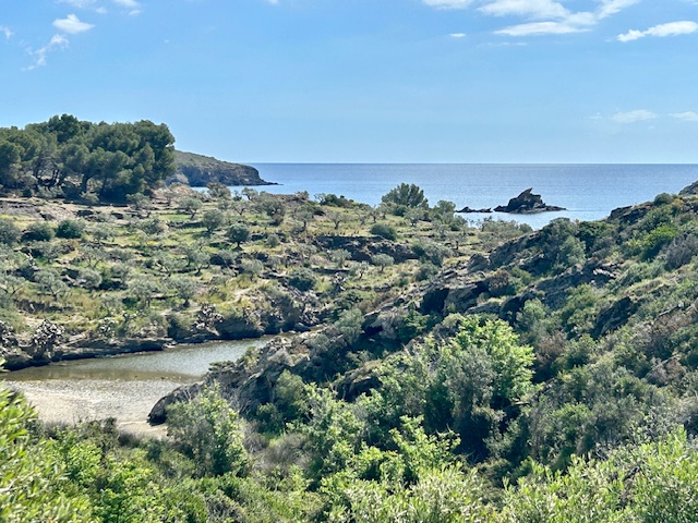
My walk to the lighthouse began from the Wecamp Campsite in Cadaques. You must follow the road to start with. It leads past the Hermitage of San Baldiri and on to Salvador Dali’s old house in PortLligat but after PortLligat you can leave the road and follow a series of coastal trails all the way to the lighthouse. The one I followed takes you along past the pretty beaches of S’Alqueria Gran and S’Alqueria Petite and then around the even prettier beaches of the Badia Guillola. It’s not hard walking (young children can easily handle the trail) but gradually the beaches give way to a more rugged landscape. There are few trees; it is mostly scrub vegetation but the lack of trees facilitates sweeping views along an increasingly jagged coastline of small cliffs, rocky coves and tiny islands. The sea is crystal clear.

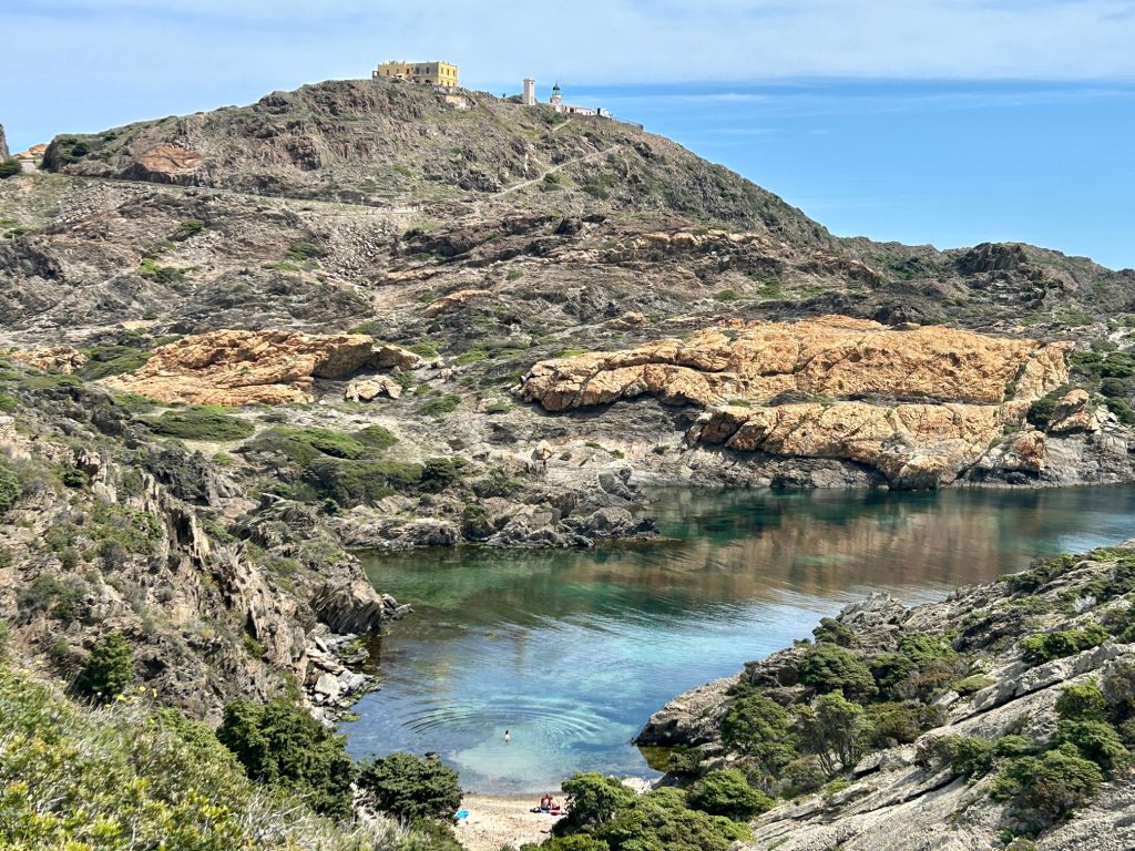
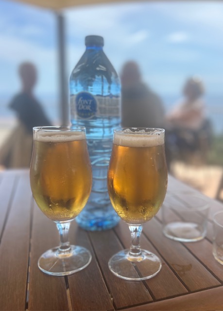
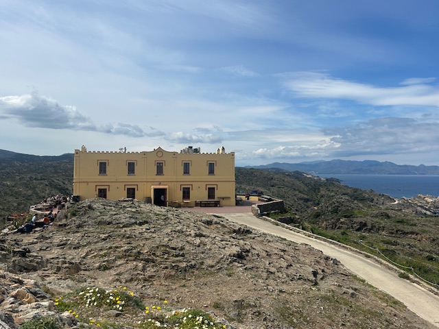
I knew I was close to the lighthouse when I started seeing small groups of people. I’d not seen a single person during the 2 hours or so that I had been walking and taking photographs but there were plenty of people milling around the lighthouse. There were a dozen or so boats moored in the cove to the south of the lighthouse and a coach (probably from Roses) pulled up as I reached the cafe-bar. My first priority was a couple of cold beers and I promise you the first one didn’t touch the sides of my throat – I drank it so quickly.
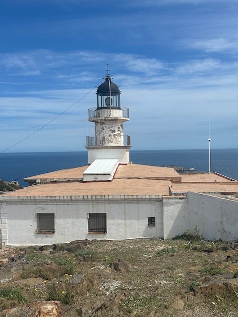
The lighthouse was built in 1853 and is the second oldest in Spain. It’s a rather average looking lighthouse and there’s little else I can say about it except that it featured in the 1971 film ‘Lighthouse At The End Of The World’, starring Kirk Douglas and Yul Brynner. No, I’ve never heard of the film either.
There’s a track near the lighthouse which leads down to the ‘Cova del Infern’ (the Cave of Hell). It’s a tunnel eroded by the sea and best viewed, I suspect, by boat. I didn’t bother with it. I didn’t bother with the unusual looking restaurant either (there were too many people there, queuing to get in) but I subsequently discovered that the restaurant is a converted police barracks. After taking a obligatory photos of the various buildings, I set off to explore the coastline to the north of the lighthouse.
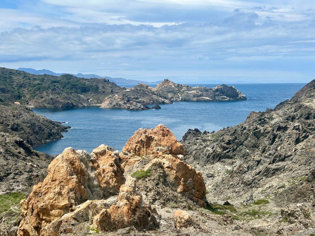
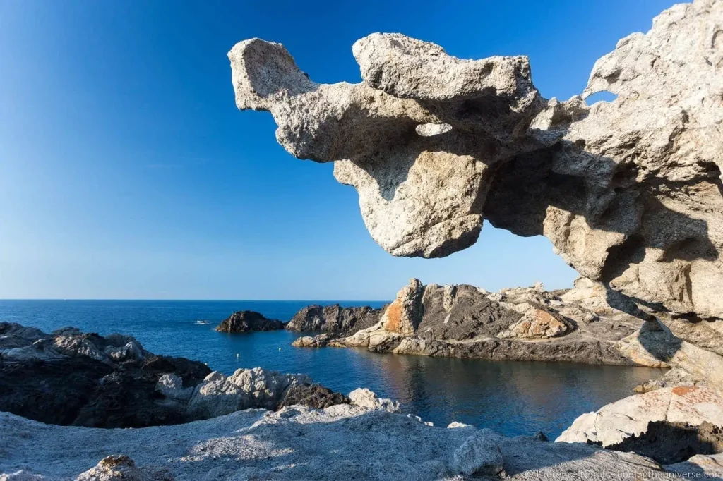
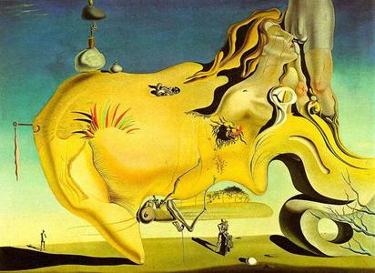
I think the coastline to the north of the peninsula (especially around the Pareja de Tudela) is, by a long way, the most interesting. There’s more exposed lava rock to the north of the lighthouse and the area is considerably more rugged. Erosion caused by the sea and, in all likelihood, the strong tramuntana winds which blow down from the Pyrenees has made this part of the cape nothing less than fascinating. This is an area that especially intrigued Salvador Dali. He often walked the area, seemingly obsessed with the strange rock formations with names like the Camel, the Eagle and the Rabbit and; it is said that at least one of his paintings, ‘The Great Masturbator’ was inspired by one or more of these rock formations.
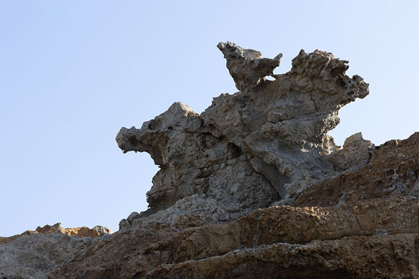
I’ll end this blog with one more anecdote about the Pareja de Tudela area and then leave you with my favourite photo from the area to the north of the lighthouse.
Between 1964 and 2004, this part of the coastline was owned by Club Med and they built a huge and very successful holiday complex here. There’s little left of it now. After the Spanish government decided the peninsula was to become a national park and marine reserve, Club Med were on notice to leave. Once the complex closed, a decision was made to totally dismantle it and; in 2009 some 430 buildings were levelled and removed. Even garden flowers planted by Club Med were uprooted and disposed of if they were not indigenous to the area. Wonderful.